 Updated: March, 2023
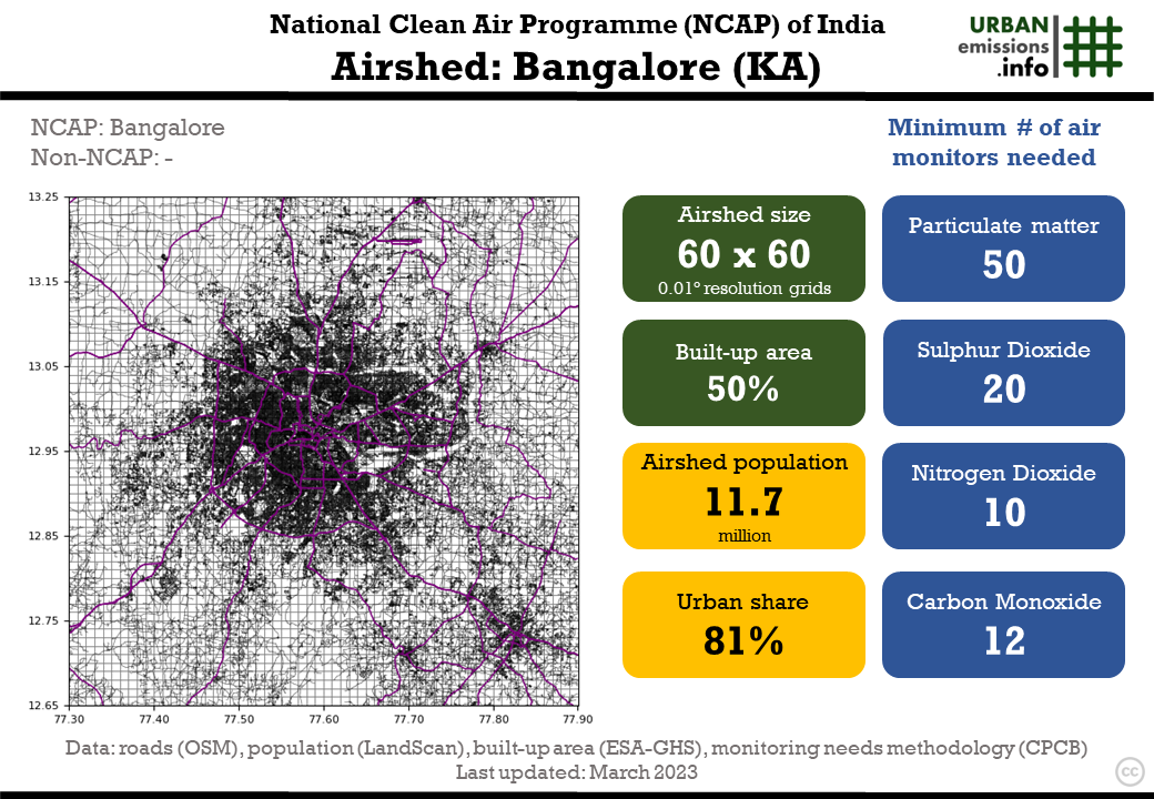
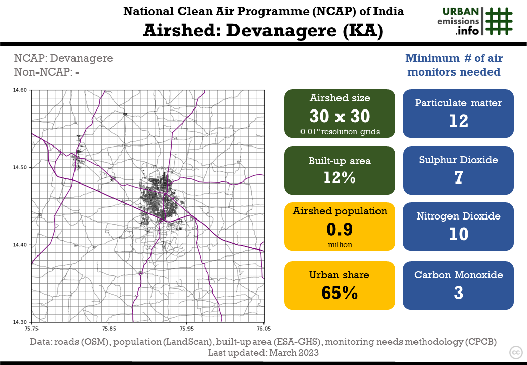
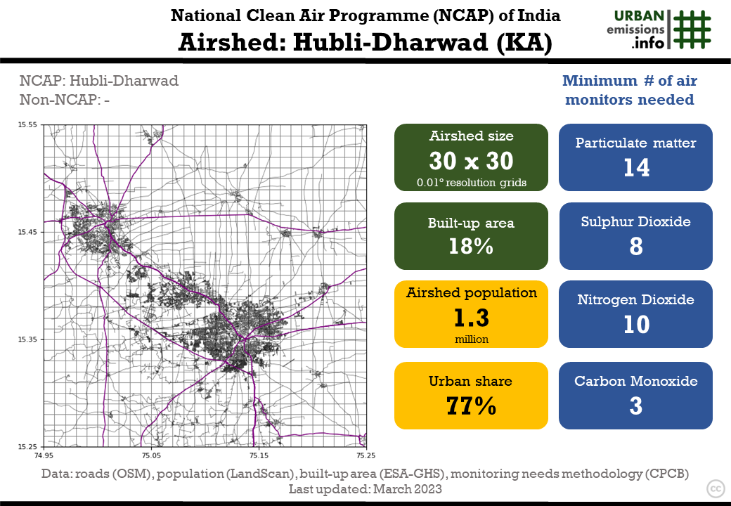
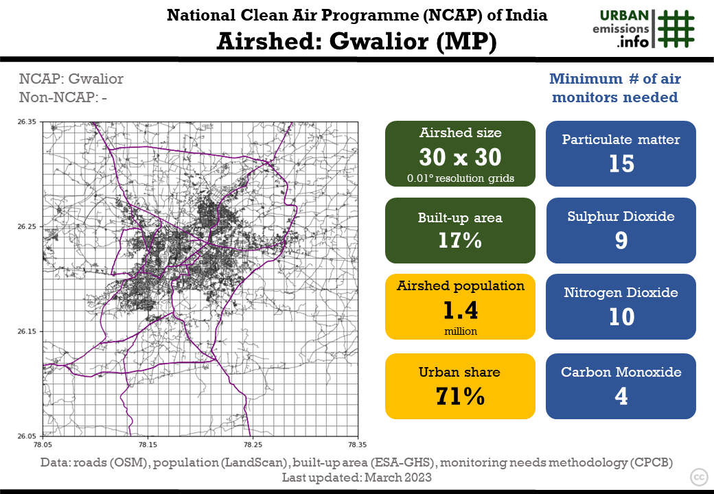
131 NCAP non-attainment cities are grouped into 104 airsheds. For each airshed, we defined (a) the size of NCAP city airsheds (b) the recommended number of ambient air quality monitoring sites in an airshed (c) the operational sampling frequency to support receptor-based source apportionment studies. These resources are necessary for strengthening the monitoring needs of an airshed to track pollution levels, to conduct receptor-model-based source apportionment studies, and to support long-term air quality management plans.
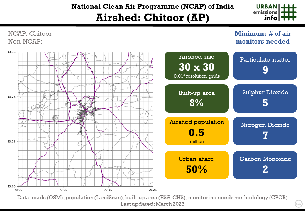
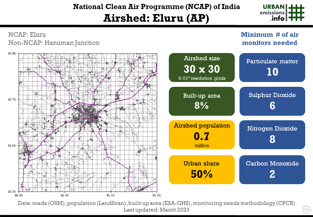
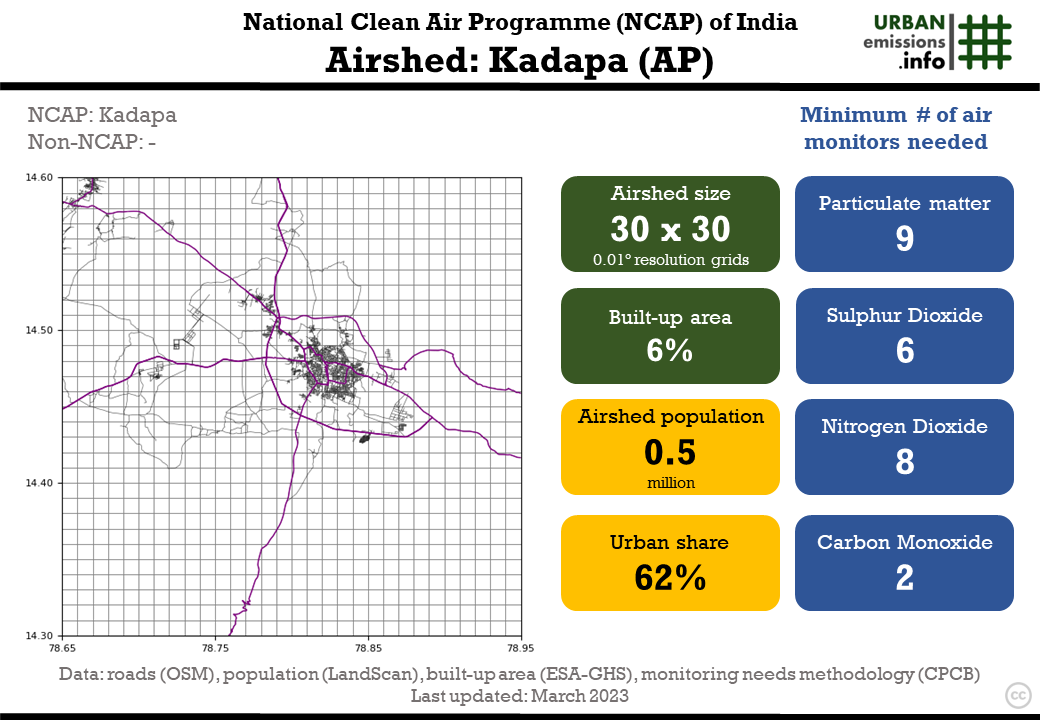
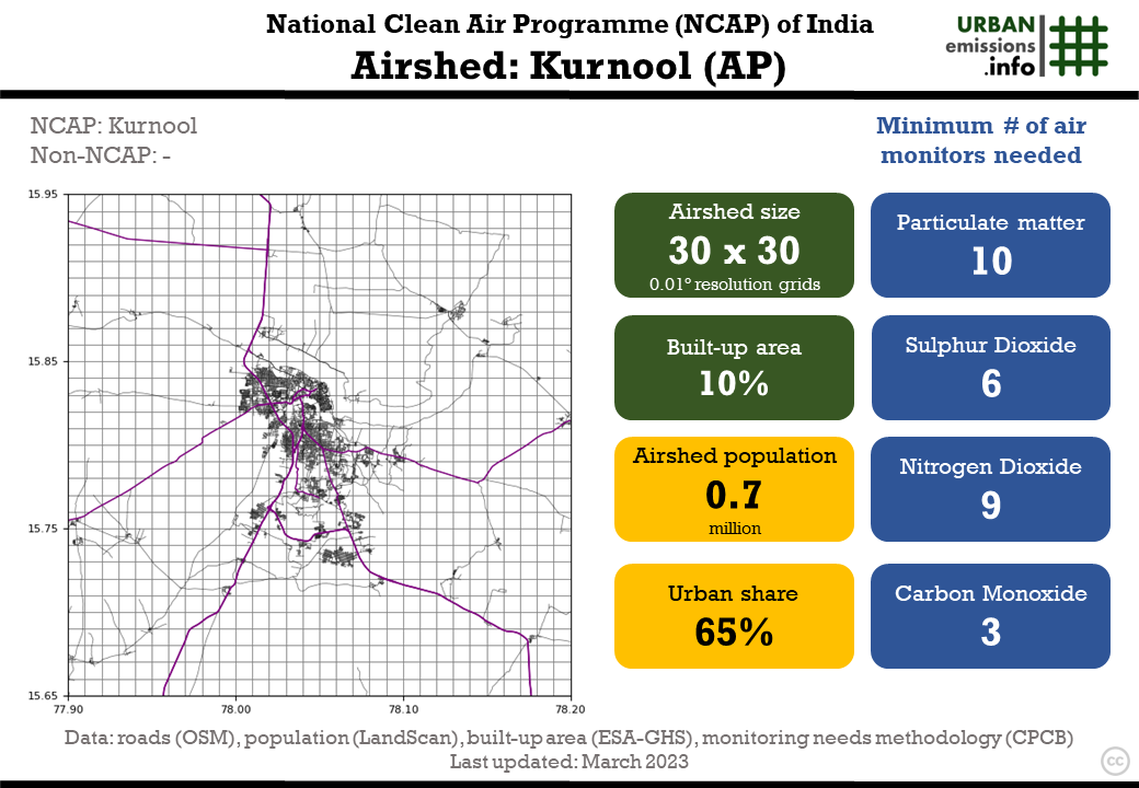
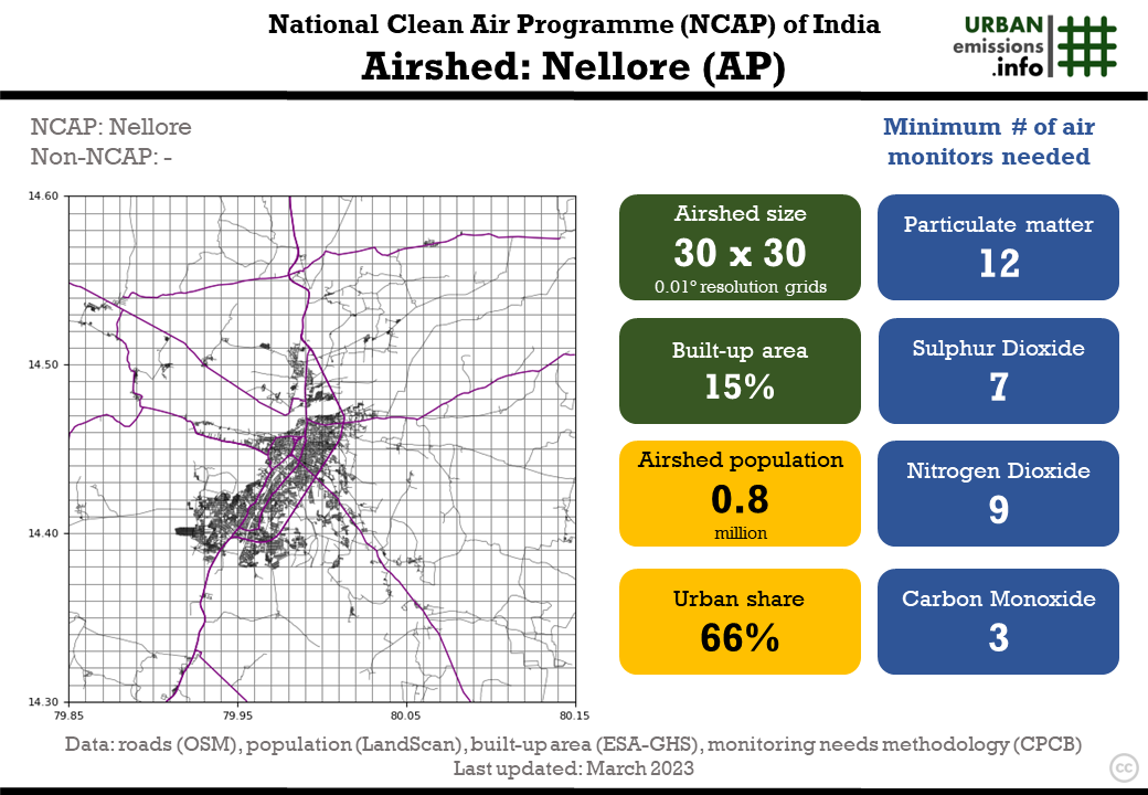
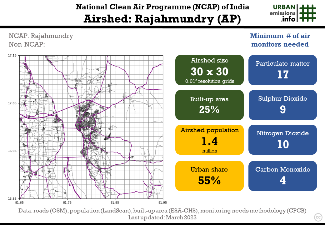
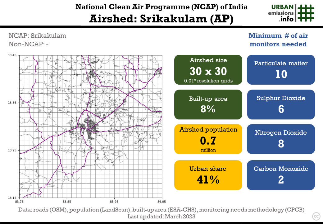
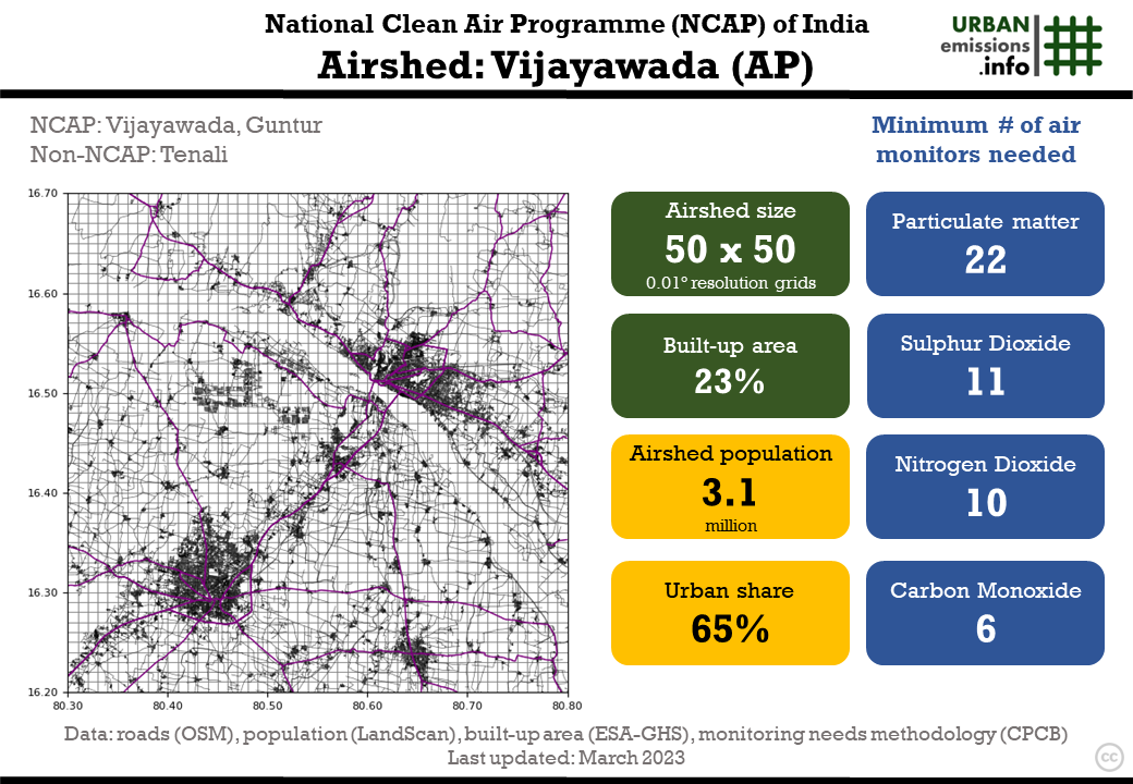
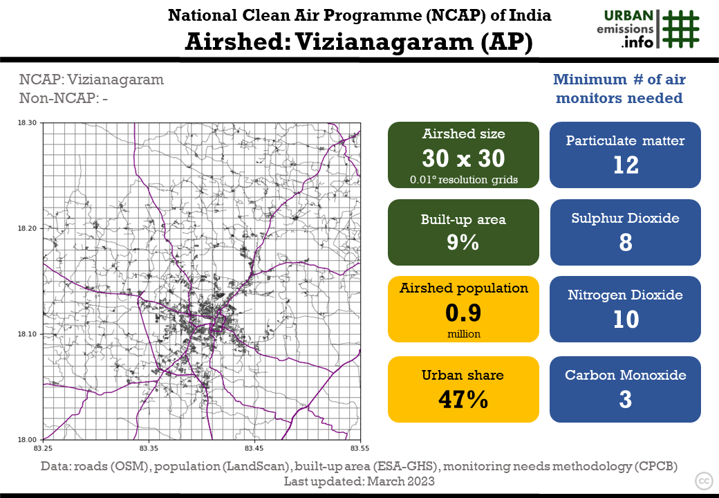
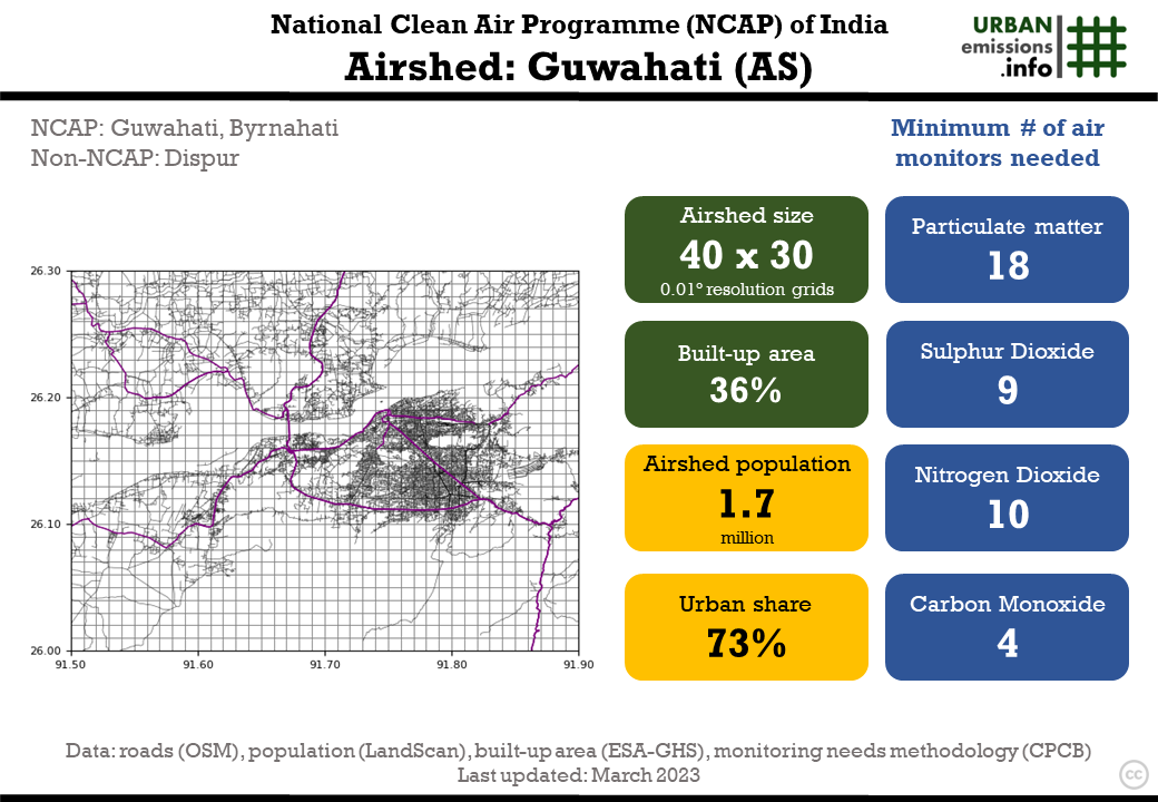
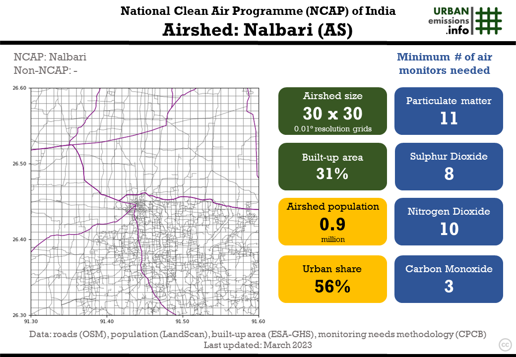
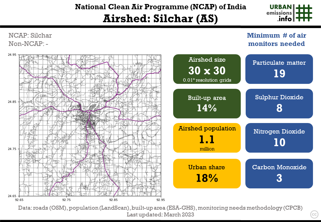
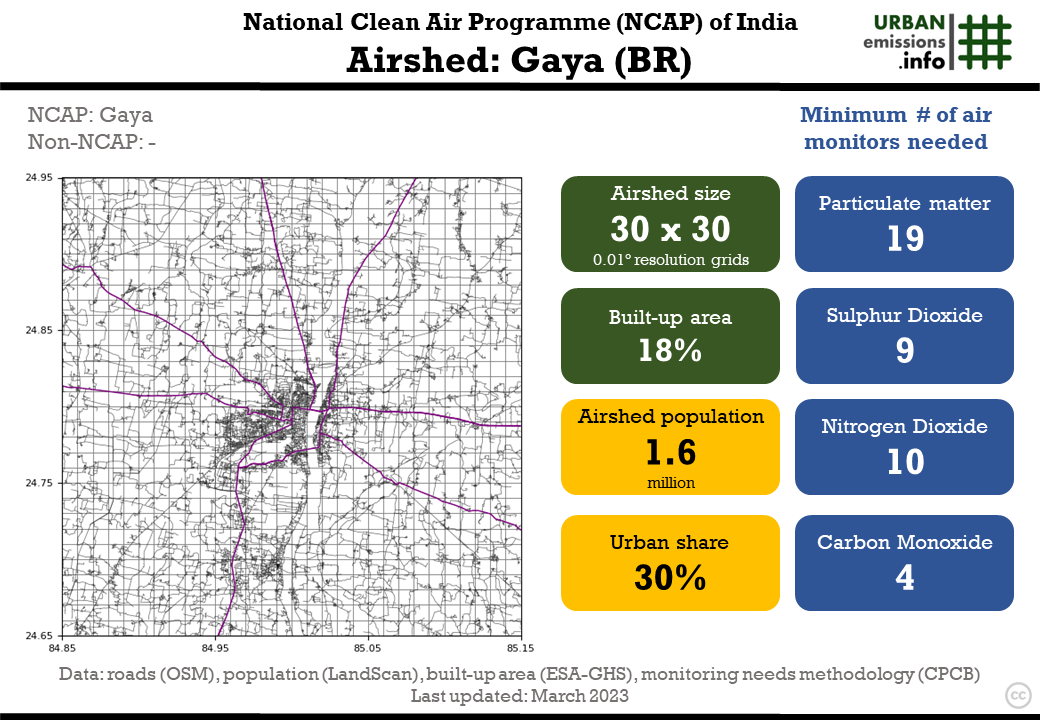
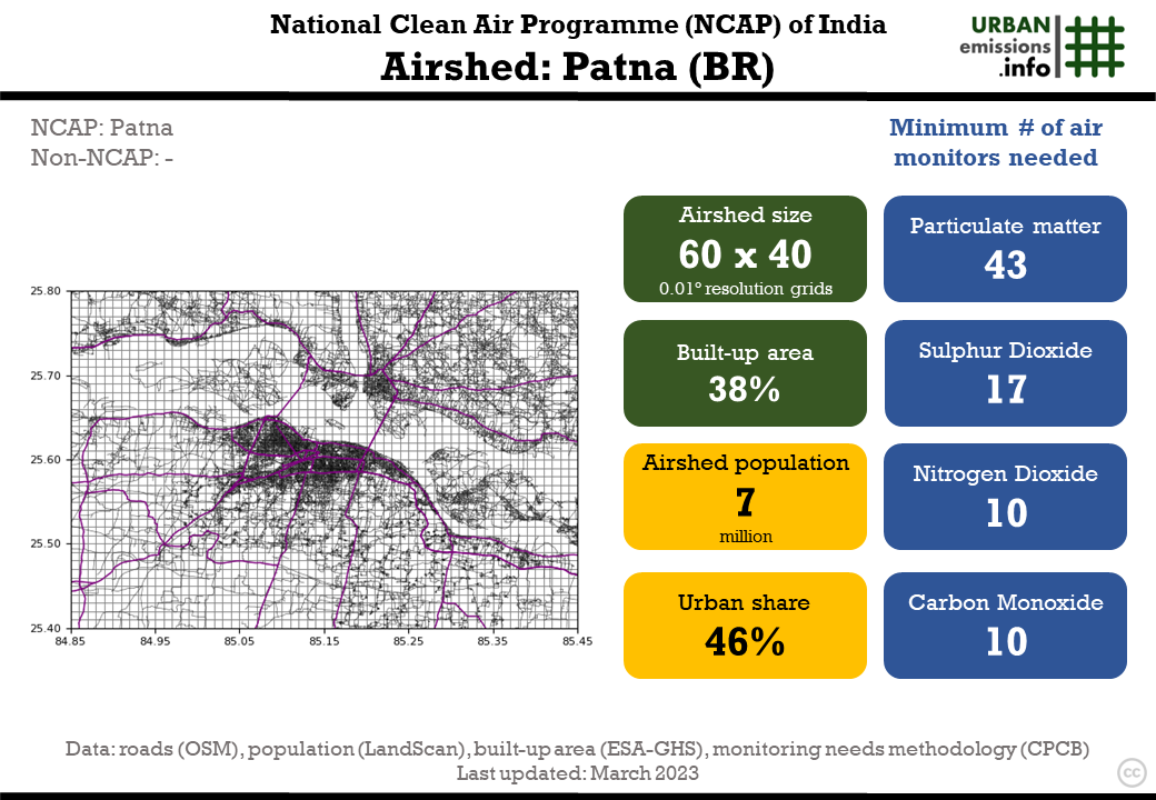
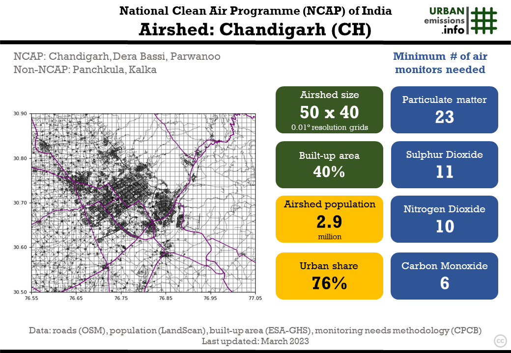
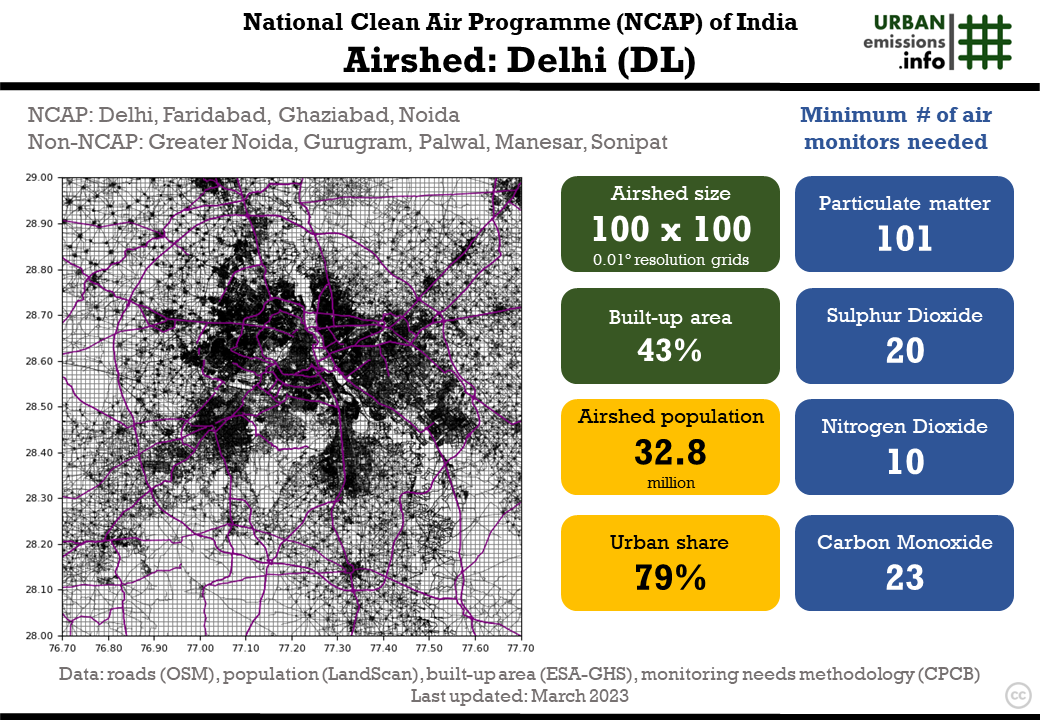
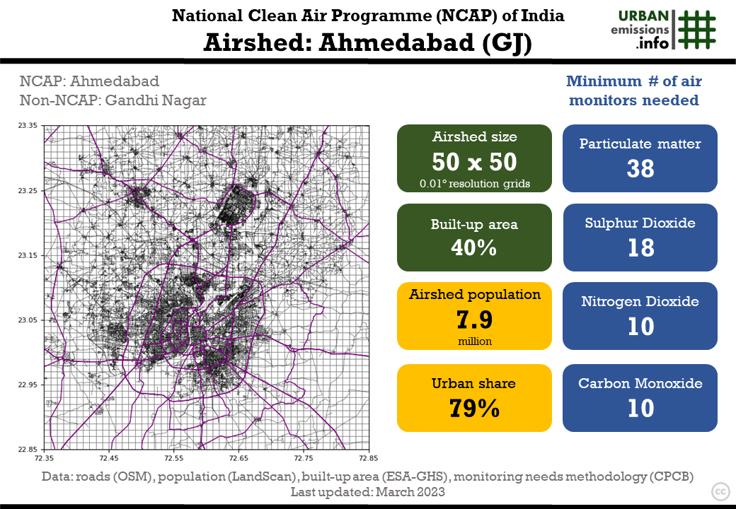
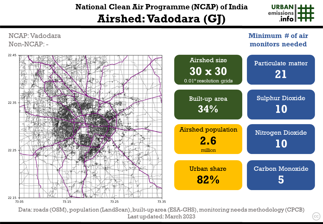
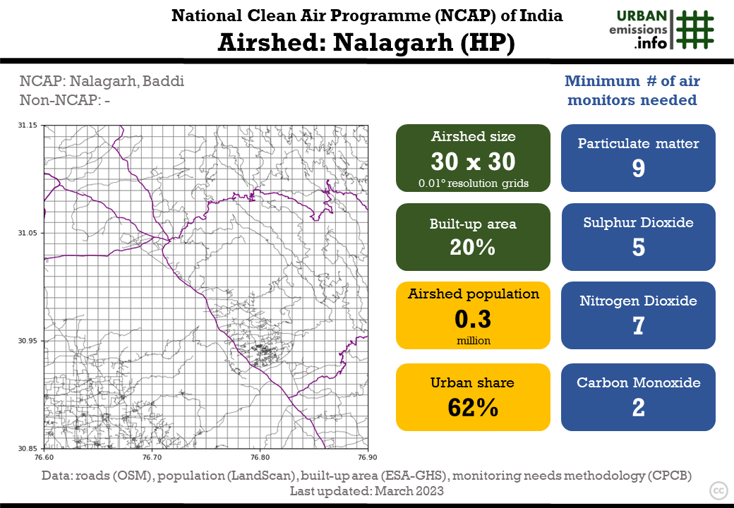
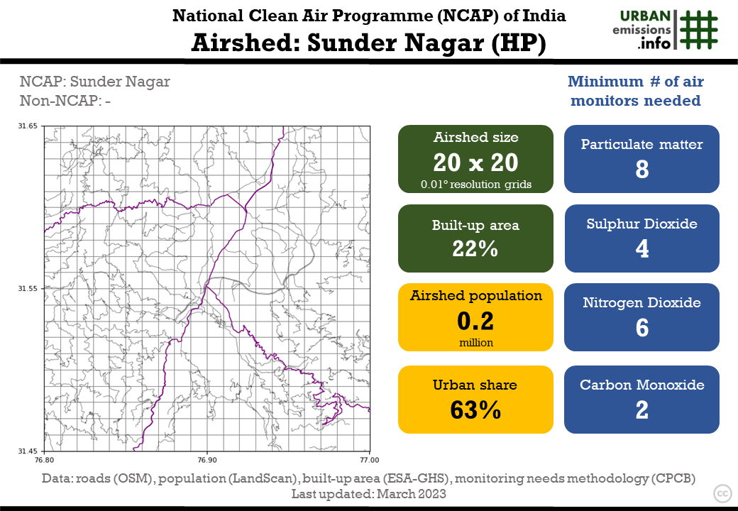
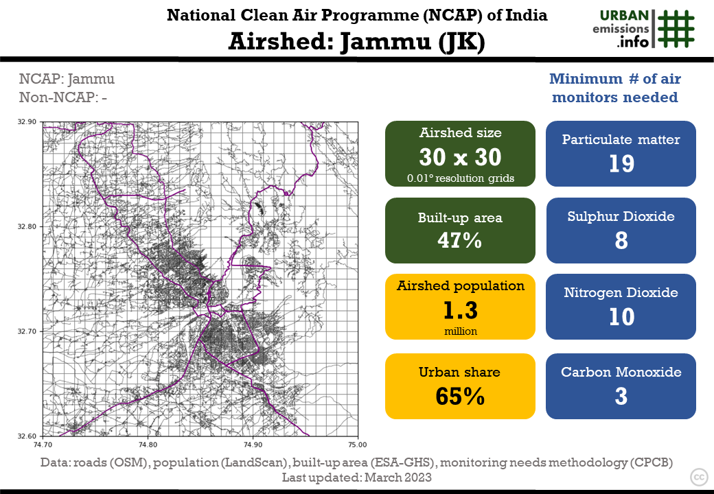
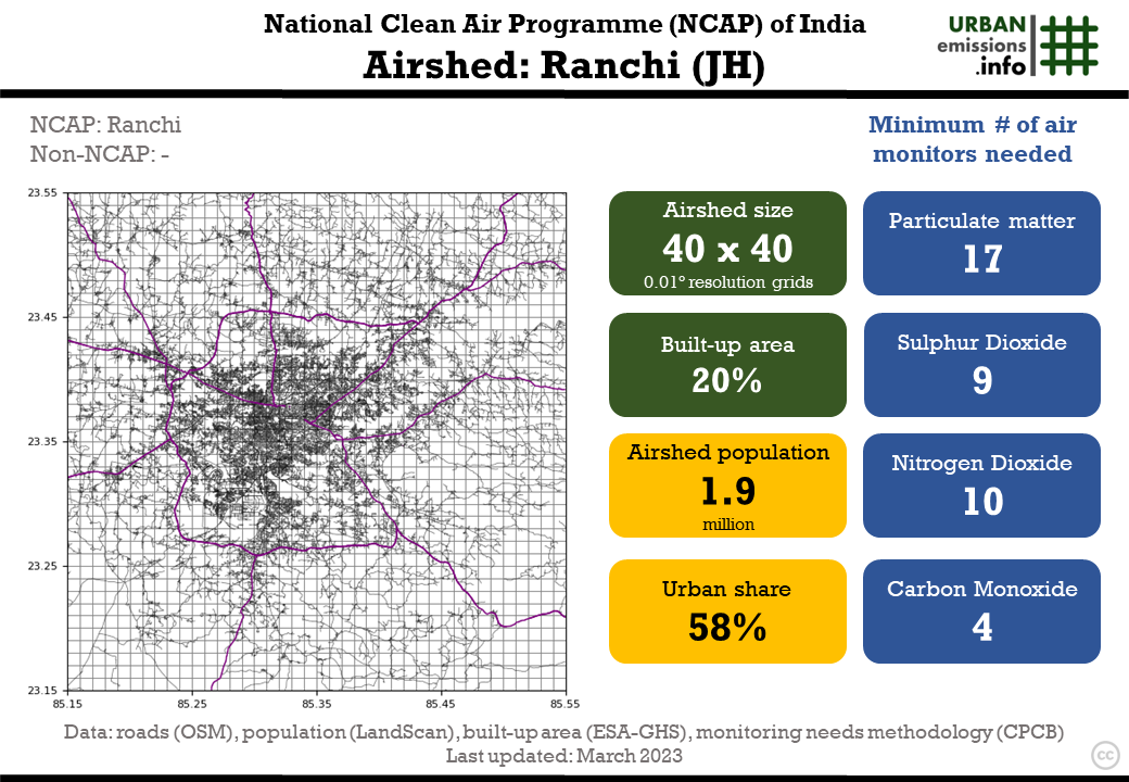
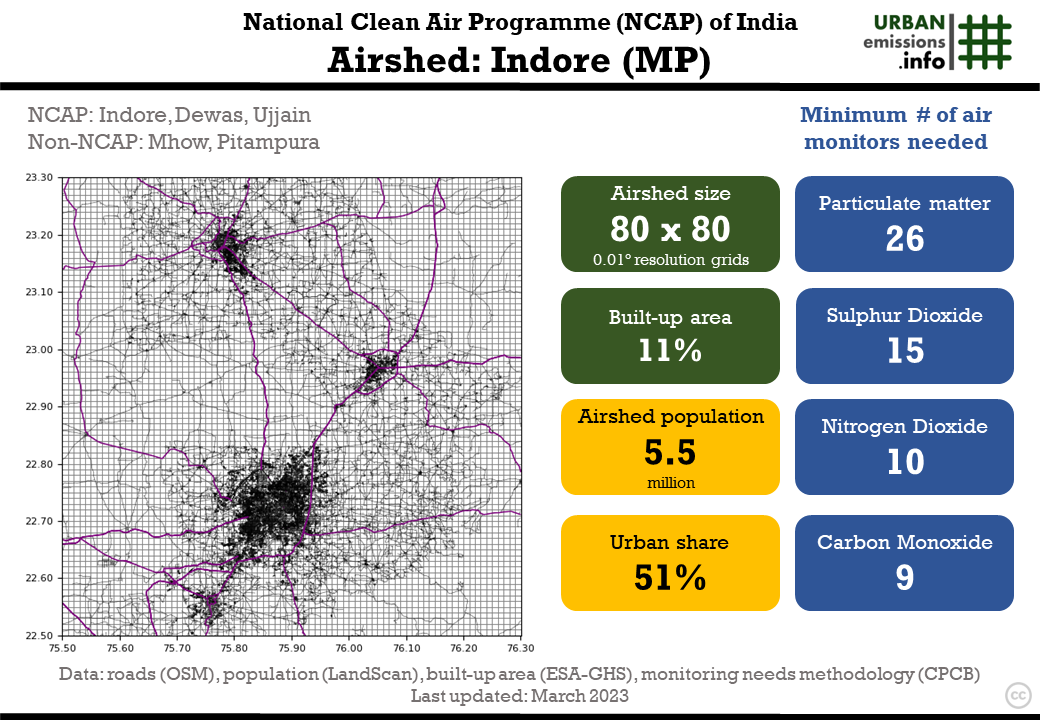
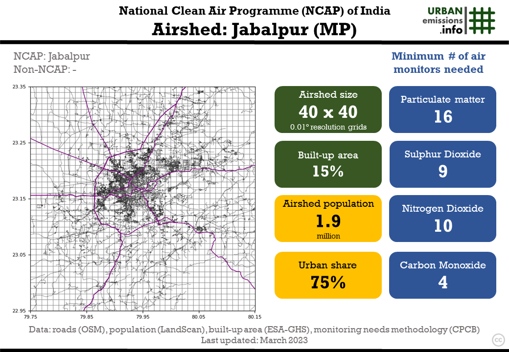
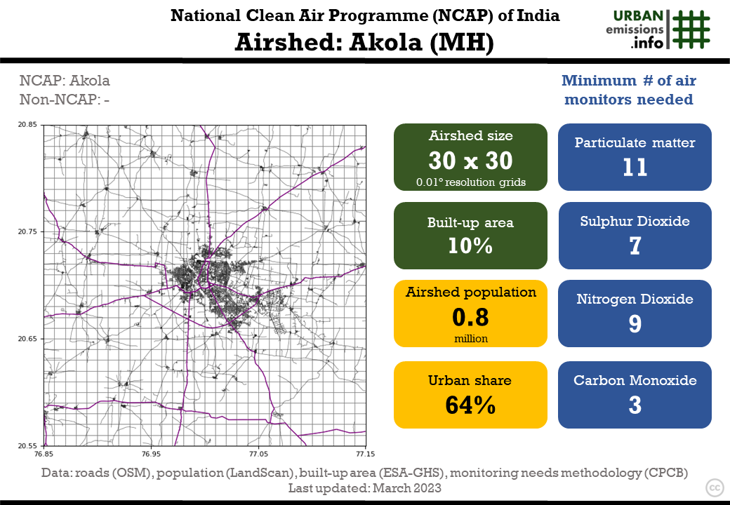
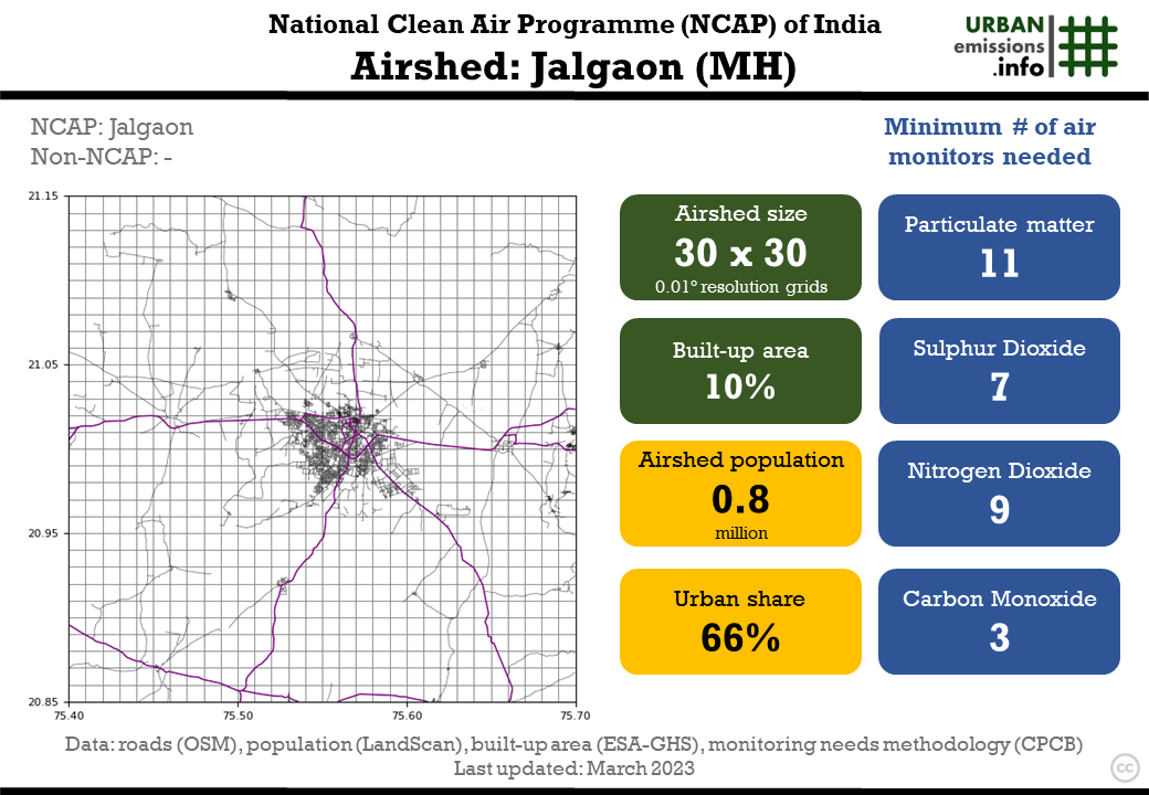
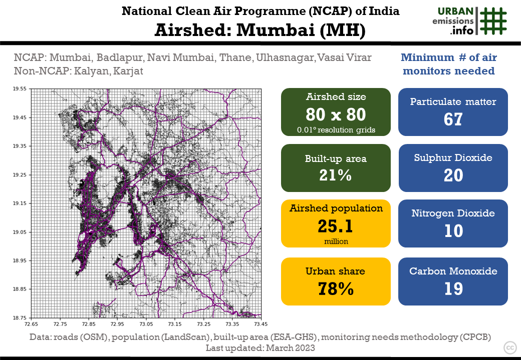
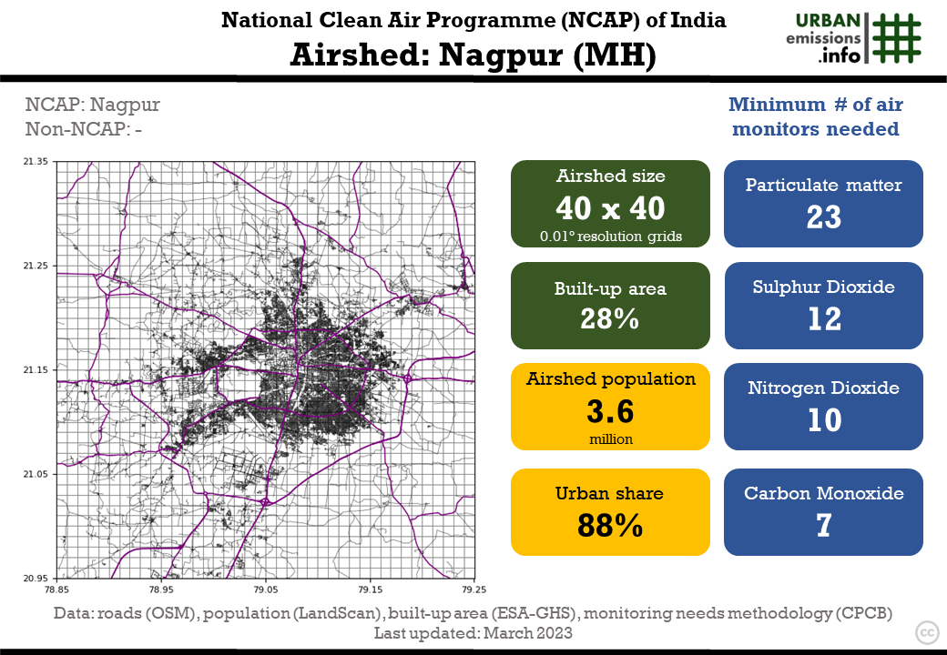
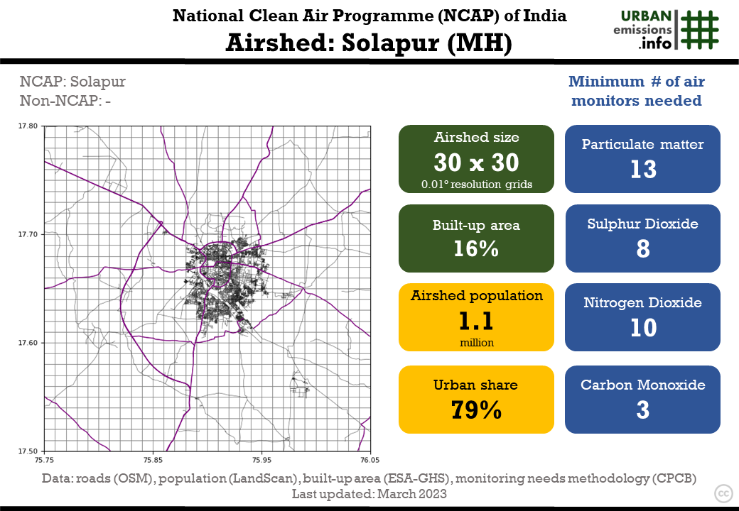
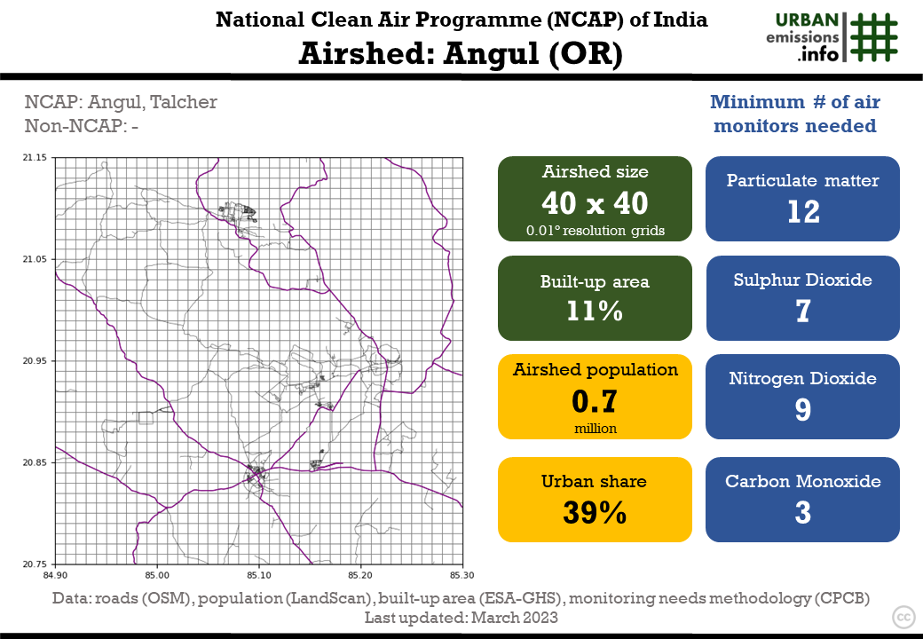
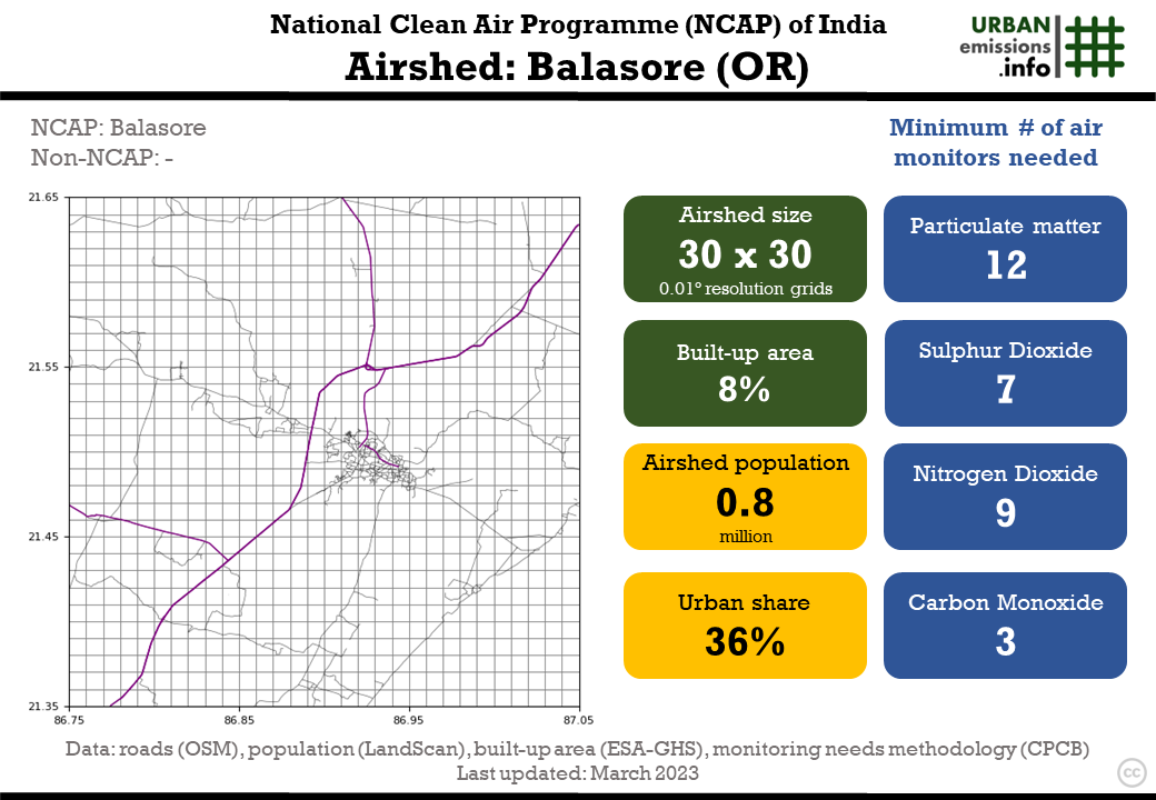
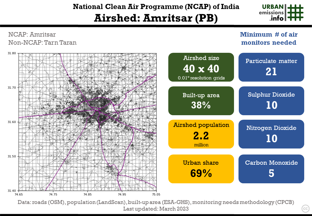
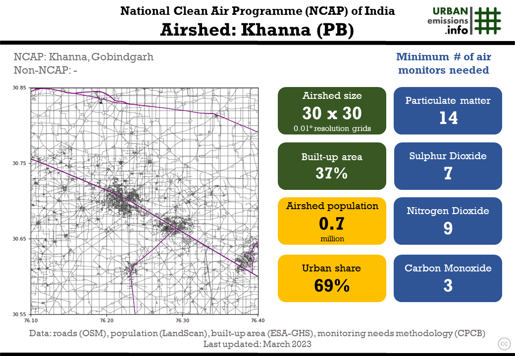
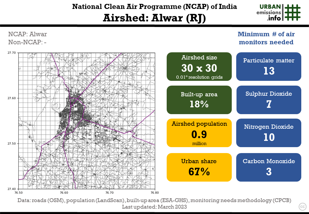
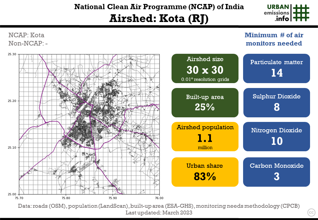
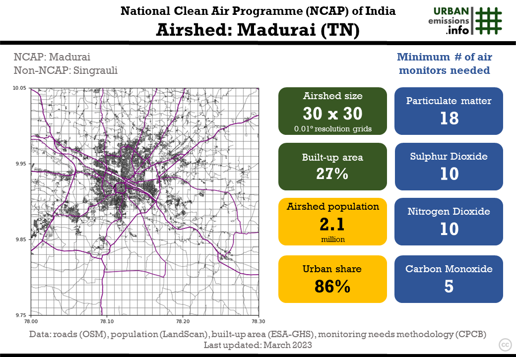
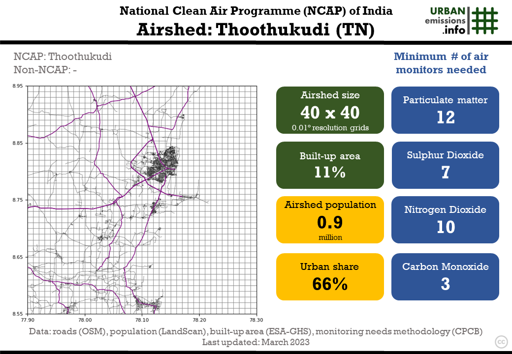
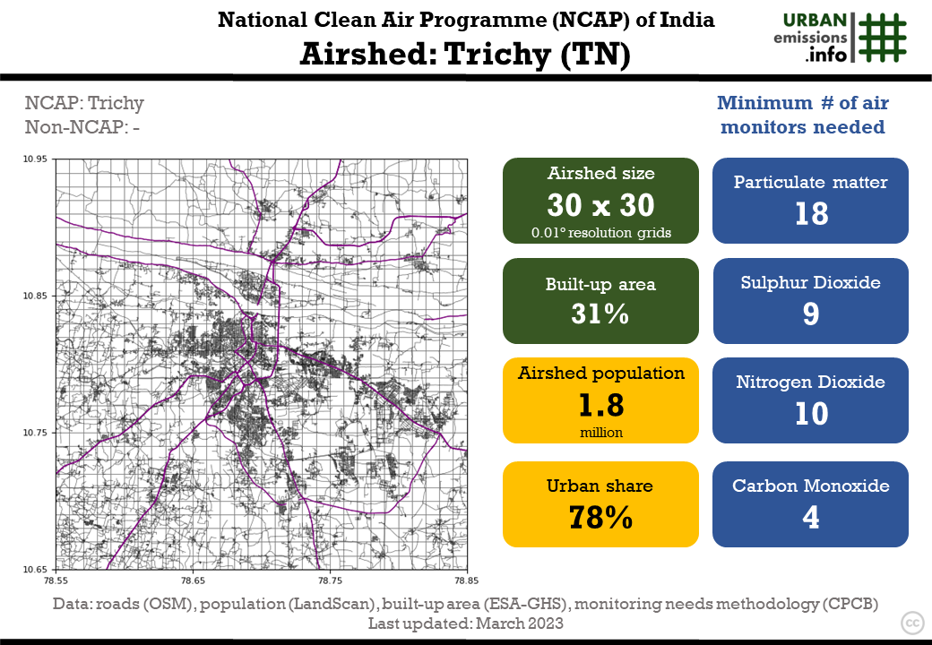
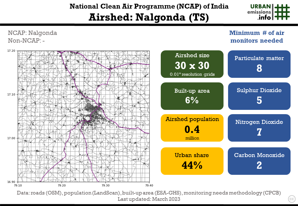
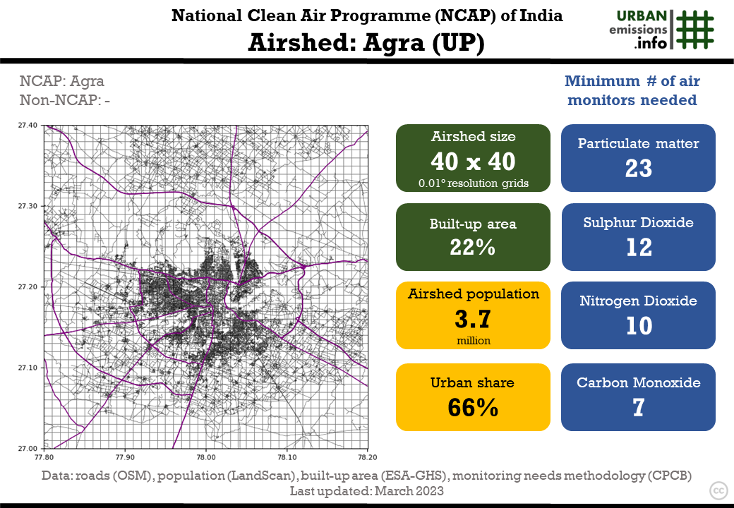
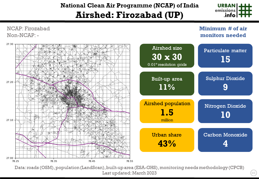
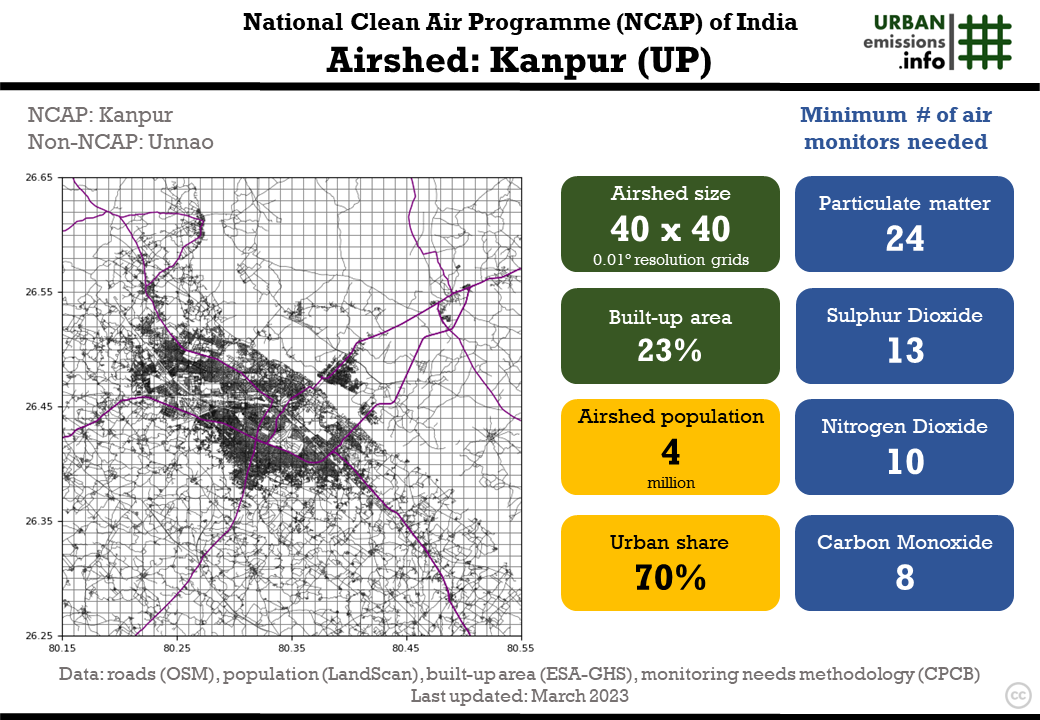
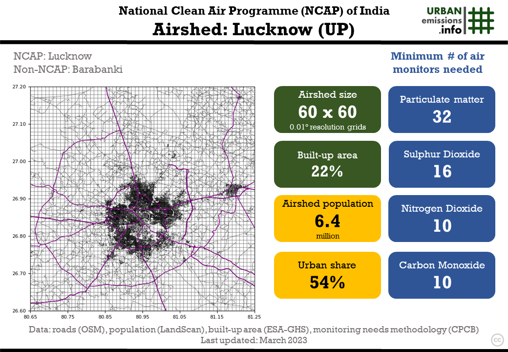
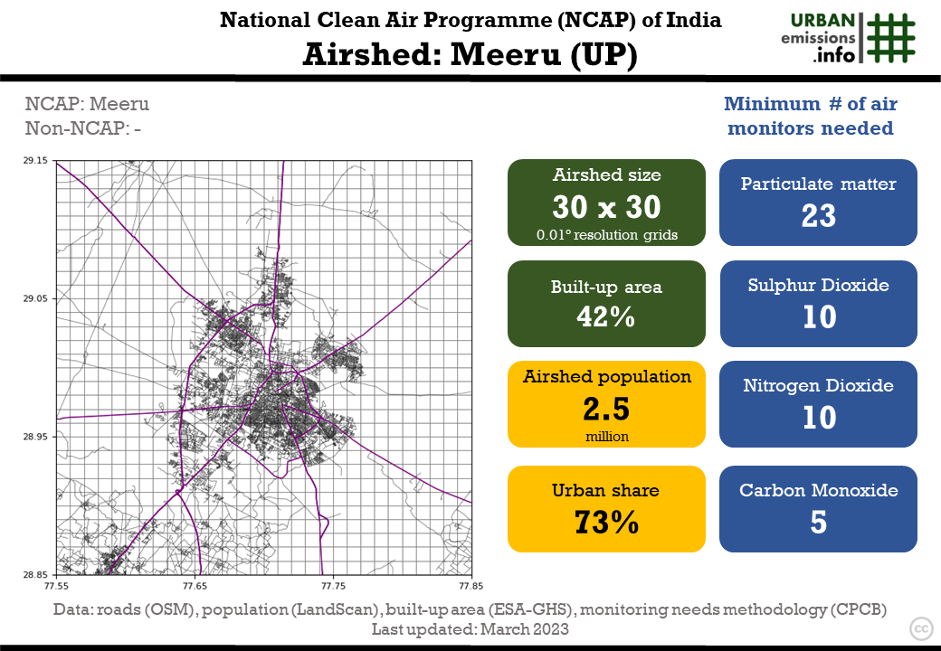
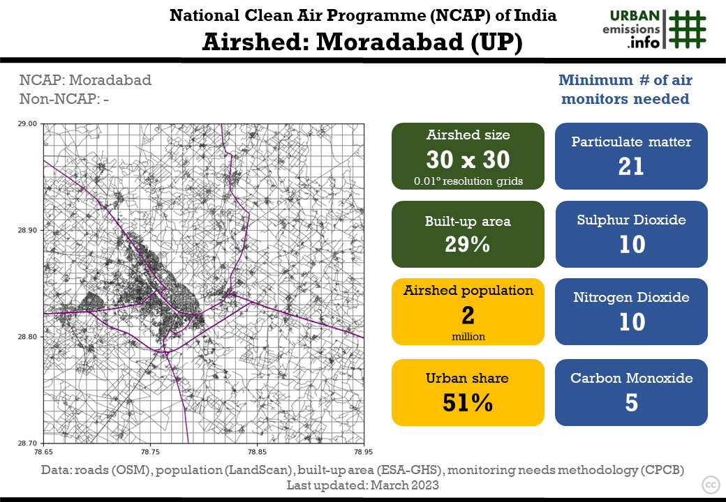
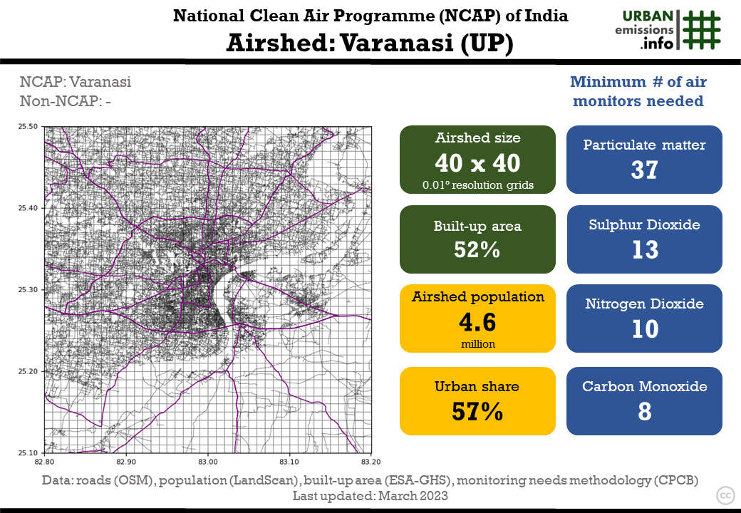
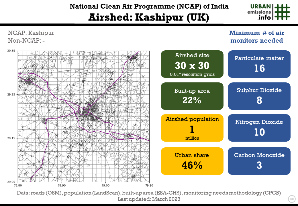
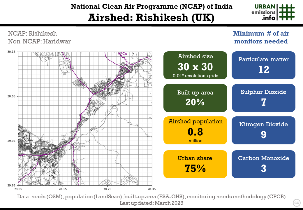
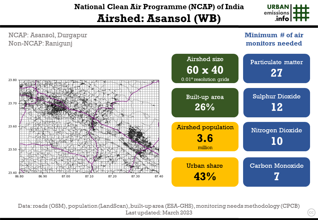
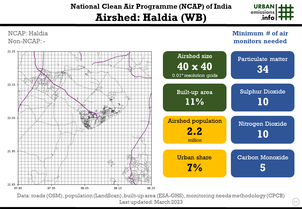
The table below presents details at the airshed level on (a) NCAP and non-NCAP cities (b) minimum number of monitors recommended for monitoring PM, SO2, NO2, CO, and other pollutants and (c) an infograph with additional information on the airshed – size, built-up area share, total population, and urban population share.
Journal Article on airshed designation process and monitoring needs (2023): here
Journal article with review of NCAP action plans (2020): here
Download full resolution animation (of all 104 airsheds): here (or click on the image)
Back to NCAP data repository.
Recommended number of minimum air quality monitors for NCAP airsheds
| No | state | Airshed | Other NCAP cities | Non-NCAP cities | PM Monitors | SO2 Monitors | NO2 Monitors | CO & other monitors | Infograph |
|---|---|---|---|---|---|---|---|---|---|
| 1 | Andhra Pradesh | Anantapur | 10 | 6 | 8 | 2 | PNG | ||
| 2 | Andhra Pradesh | Chitoor | 9 | 5 | 7 | 2 | PNG | ||
| 3 | Andhra Pradesh | Eluru | Hanuman Junction | 10 | 6 | 8 | 2 | PNG | |
| 4 | Andhra Pradesh | Kadapa | 9 | 6 | 8 | 2 | PNG | ||
| 5 | Andhra Pradesh | Kurnool | 10 | 6 | 9 | 3 | PNG | ||
| 6 | Andhra Pradesh | Nellore | 12 | 7 | 9 | 3 | PNG | ||
| 7 | Andhra Pradesh | Ongole | 9 | 5 | 7 | 2 | PNG | ||
| 8 | Andhra Pradesh | Rajahmundry | 17 | 9 | 10 | 4 | PNG | ||
| 9 | Andhra Pradesh | Srikakulam | 10 | 6 | 8 | 2 | PNG | ||
| 10 | Andhra Pradesh | Vijayawada | Guntur | Tenali | 22 | 11 | 10 | 6 | PNG |
| 11 | Andhra Pradesh | Vishakhapatnam | Anakapalle | 20 | 11 | 10 | 6 | PNG | |
| 12 | Andhra Pradesh | Vizianagaram | 12 | 8 | 10 | 3 | PNG | ||
| 13 | Assam | Guwahati | Byrnahati | Dispur | 18 | 9 | 10 | 4 | PNG |
| 14 | Assam | Nagaon | 36 | 8 | 10 | 3 | PNG | ||
| 15 | Assam | Nalbari | 11 | 8 | 10 | 3 | PNG | ||
| 16 | Assam | Sibsagar | 12 | 5 | 7 | 2 | PNG | ||
| 17 | Assam | Silchar | 19 | 8 | 10 | 3 | PNG | ||
| 18 | Bihar | Gaya | 19 | 9 | 10 | 4 | PNG | ||
| 19 | Bihar | Muzaffarpur | 35 | 11 | 10 | 6 | PNG | ||
| 20 | Bihar | Patna | 43 | 17 | 10 | 10 | PNG | ||
| 21 | Chandigarh | Chandigarh | Dera Bassi, Parwanoo | Panchkula, Kalka | 23 | 11 | 10 | 6 | PNG |
| 22 | Chhattisgarh | Korba | 12 | 7 | 10 | 3 | PNG | ||
| 23 | Chhattisgarh | Raipur | Bhillai | Durg | 22 | 11 | 10 | 6 | PNG |
| 24 | Delhi | Delhi | Faridabad, Ghaziabad, Noida | Greater Noida, Gurugram, Palwal, Manesar, Sonipat | 101 | 20 | 10 | 23 | PNG |
| 25 | Gujarat | Ahmedabad | Gandhi Nagar | 38 | 18 | 10 | 10 | PNG | |
| 26 | Gujarat | Rajkot | 16 | 9 | 10 | 4 | PNG | ||
| 27 | Gujarat | Surat | Hazira | 30 | 15 | 10 | 9 | PNG | |
| 28 | Gujarat | Vadodara | 21 | 10 | 10 | 5 | PNG | ||
| 29 | Himachal Pradesh | Kala Amb | 9 | 5 | 7 | 2 | PNG | ||
| 30 | Himachal Pradesh | Nalagarh | Baddi | 9 | 5 | 7 | 2 | PNG | |
| 31 | Himachal Pradesh | Paonta Sahib | 7 | 4 | 5 | 2 | PNG | ||
| 32 | Himachal Pradesh | Sunder Nagar | 8 | 4 | 6 | 2 | PNG | ||
| 33 | Jammu & Kashmir | Jammu | 19 | 8 | 10 | 3 | PNG | ||
| 34 | Jammu & Kashmir | Srinagar | 23 | 10 | 10 | 5 | PNG | ||
| 35 | Jharkhand | Dhanbad | 28 | 12 | 10 | 7 | PNG | ||
| 36 | Jharkhand | Jamshedpur | Bokaro, Jaropokhar | 16 | 10 | 10 | 5 | PNG | |
| 37 | Jharkhand | Ranchi | 17 | 9 | 10 | 4 | PNG | ||
| 38 | Karnataka | Bangalore | 50 | 20 | 10 | 12 | PNG | ||
| 39 | Karnataka | Devanagere | 12 | 7 | 10 | 3 | PNG | ||
| 40 | Karnataka | Gulburga | 11 | 7 | 9 | 3 | PNG | ||
| 41 | Karnataka | Hubli-Dharwad | 14 | 8 | 10 | 3 | PNG | ||
| 42 | Madhya Pradesh | Bhopal | 19 | 10 | 10 | 5 | PNG | ||
| 43 | Madhya Pradesh | Gwalior | 15 | 9 | 10 | 4 | PNG | ||
| 44 | Madhya Pradesh | Indore | Dewas, Ujjain | Mhow, Pitampura | 26 | 15 | 10 | 9 | PNG |
| 45 | Madhya Pradesh | Jabalpur | 16 | 9 | 10 | 4 | PNG | ||
| 46 | Madhya Pradesh | Sagar | 9 | 6 | 8 | 2 | PNG | ||
| 47 | Maharashtra | Akola | 11 | 7 | 9 | 3 | PNG | ||
| 48 | Maharashtra | Amravati | 12 | 8 | 10 | 3 | PNG | ||
| 49 | Maharashtra | Aurangabad | 16 | 9 | 10 | 4 | PNG | ||
| 50 | Maharashtra | Chandrapur | 11 | 7 | 9 | 3 | PNG | ||
| 51 | Maharashtra | Jalgaon | 11 | 7 | 9 | 3 | PNG | ||
| 52 | Maharashtra | Jalna | 9 | 6 | 8 | 2 | PNG | ||
| 53 | Maharashtra | Kolhapur | Sangli | 26 | 12 | 10 | 7 | PNG | |
| 54 | Maharashtra | Latur | 11 | 7 | 9 | 3 | PNG | ||
| 55 | Maharashtra | Mumbai | Badlapur, Navi Mumbai, Thane, Ulhasnagar, Vasai Virar | Kalyan, Karjat | 67 | 20 | 10 | 19 | PNG |
| 56 | Maharashtra | Nagpur | 23 | 12 | 10 | 7 | PNG | ||
| 57 | Maharashtra | Nashik | 20 | 10 | 10 | 5 | PNG | ||
| 58 | Maharashtra | Pune | Pimpri-Chinchwad, Hinjewadi | 40 | 17 | 10 | 10 | PNG | |
| 59 | Maharashtra | Solapur | 13 | 8 | 10 | 3 | PNG | ||
| 60 | Nagaland | Dimapur | 10 | 5 | 7 | 2 | PNG | ||
| 61 | Nagaland | Kohima | 7 | 4 | 6 | 2 | PNG | ||
| 62 | Orissa | Angul | Talcher | 12 | 7 | 9 | 3 | PNG | |
| 63 | Orissa | Balasore | 12 | 7 | 9 | 3 | PNG | ||
| 64 | Orissa | Bhubaneswar | Cuttack, Kalinga Nagar | 22 | 11 | 10 | 6 | PNG | |
| 65 | Orissa | Rourkela | 15 | 8 | 10 | 3 | PNG | ||
| 66 | Punjab | Amritsar | Tarn Taran | 21 | 10 | 10 | 5 | PNG | |
| 67 | Punjab | Jalandhar | Phagwara | 22 | 9 | 10 | 4 | PNG | |
| 68 | Punjab | Khanna | Gobindgarh | 14 | 7 | 9 | 3 | PNG | |
| 69 | Punjab | Ludhiana | Philaur | 23 | 11 | 10 | 6 | PNG | |
| 70 | Punjab | Naya Nangal | Una | 11 | 5 | 7 | 2 | PNG | |
| 71 | Punjab | Pathankot/Dera Baba | Damtal | 13 | 7 | 9 | 3 | PNG | |
| 72 | Punjab | Patiala | 19 | 9 | 10 | 4 | PNG | ||
| 73 | Rajasthan | Alwar | 13 | 7 | 10 | 3 | PNG | ||
| 74 | Rajasthan | Jaipur | 31 | 13 | 10 | 8 | PNG | ||
| 75 | Rajasthan | Jodhpur | 17 | 9 | 10 | 4 | PNG | ||
| 76 | Rajasthan | Kota | 14 | 8 | 10 | 3 | PNG | ||
| 77 | Rajasthan | Udaipur | 16 | 9 | 10 | 4 | PNG | ||
| 78 | Tamil Nadu | Chennai | 46 | 20 | 10 | 12 | PNG | ||
| 79 | Tamil Nadu | Madurai | Singrauli | 18 | 10 | 10 | 5 | PNG | |
| 80 | Tamil Nadu | Thoothukudi | 12 | 7 | 10 | 3 | PNG | ||
| 81 | Tamil Nadu | Trichy | 18 | 9 | 10 | 4 | PNG | ||
| 82 | Telangana | Hyderabad | Patancheru, Sangareddy | 39 | 20 | 10 | 11 | PNG | |
| 83 | Telangana | Nalgonda | 8 | 5 | 7 | 2 | PNG | ||
| 84 | Uttar Pradesh | Agra | 23 | 12 | 10 | 7 | PNG | ||
| 85 | Uttar Pradesh | Allahabad | 28 | 12 | 10 | 7 | PNG | ||
| 86 | Uttar Pradesh | Anpara | 12 | 7 | 9 | 3 | PNG | ||
| 87 | Uttar Pradesh | Bareily | 20 | 10 | 10 | 5 | PNG | ||
| 88 | Uttar Pradesh | Firozabad | 15 | 9 | 10 | 4 | PNG | ||
| 89 | Uttar Pradesh | Gajraula | 13 | 7 | 9 | 3 | PNG | ||
| 90 | Uttar Pradesh | Gorakhpur | 24 | 10 | 10 | 5 | PNG | ||
| 91 | Uttar Pradesh | Jhansi | 13 | 8 | 10 | 3 | PNG | ||
| 92 | Uttar Pradesh | Kanpur | Unnao | 24 | 13 | 10 | 8 | PNG | |
| 93 | Uttar Pradesh | Khurja | Bulandshahr | 16 | 8 | 10 | 3 | PNG | |
| 94 | Uttar Pradesh | Lucknow | Barabanki | 32 | 16 | 10 | 10 | PNG | |
| 95 | Uttar Pradesh | Meerut | 23 | 10 | 10 | 5 | PNG | ||
| 96 | Uttar Pradesh | Moradabad | 21 | 10 | 10 | 5 | PNG | ||
| 97 | Uttar Pradesh | Raebareli | 14 | 8 | 10 | 3 | PNG | ||
| 98 | Uttar Pradesh | Varanasi | 37 | 13 | 10 | 8 | PNG | ||
| 99 | Uttarakhand | Dehradun | 15 | 8 | 10 | 3 | PNG | ||
| 100 | Uttarakhand | Kashipur | 16 | 8 | 10 | 3 | PNG | ||
| 101 | Uttarakhand | Rishikesh | Haridwar | 12 | 7 | 9 | 3 | PNG | |
| 102 | West Bengal | Asansol | Durgapur | Ranigunj | 27 | 12 | 10 | 7 | PNG |
| 103 | West Bengal | Haldia | 34 | 10 | 10 | 5 | PNG | ||
| 104 | West Bengal | Kolkata | Barrackpore, Howrah | 82 | 20 | 10 | 17 | PNG |
[Supplementary Material]
1. GIS formatted shape file with the grid information of 94 airsheds covering 122 NCAP cities
2. A summary of monthly variation of meteorological fields (a) near surface temperature (b) near surface wind speeds (c) precipitation and (d) mixing heights for all airsheds
3. A summary of pros and cons of source apportionment approaches. More on the approaches is also available as a primer
4. A summary of strengths and limitations of receptor models
5. Recommended number of ambient air quality monitors at district and state level