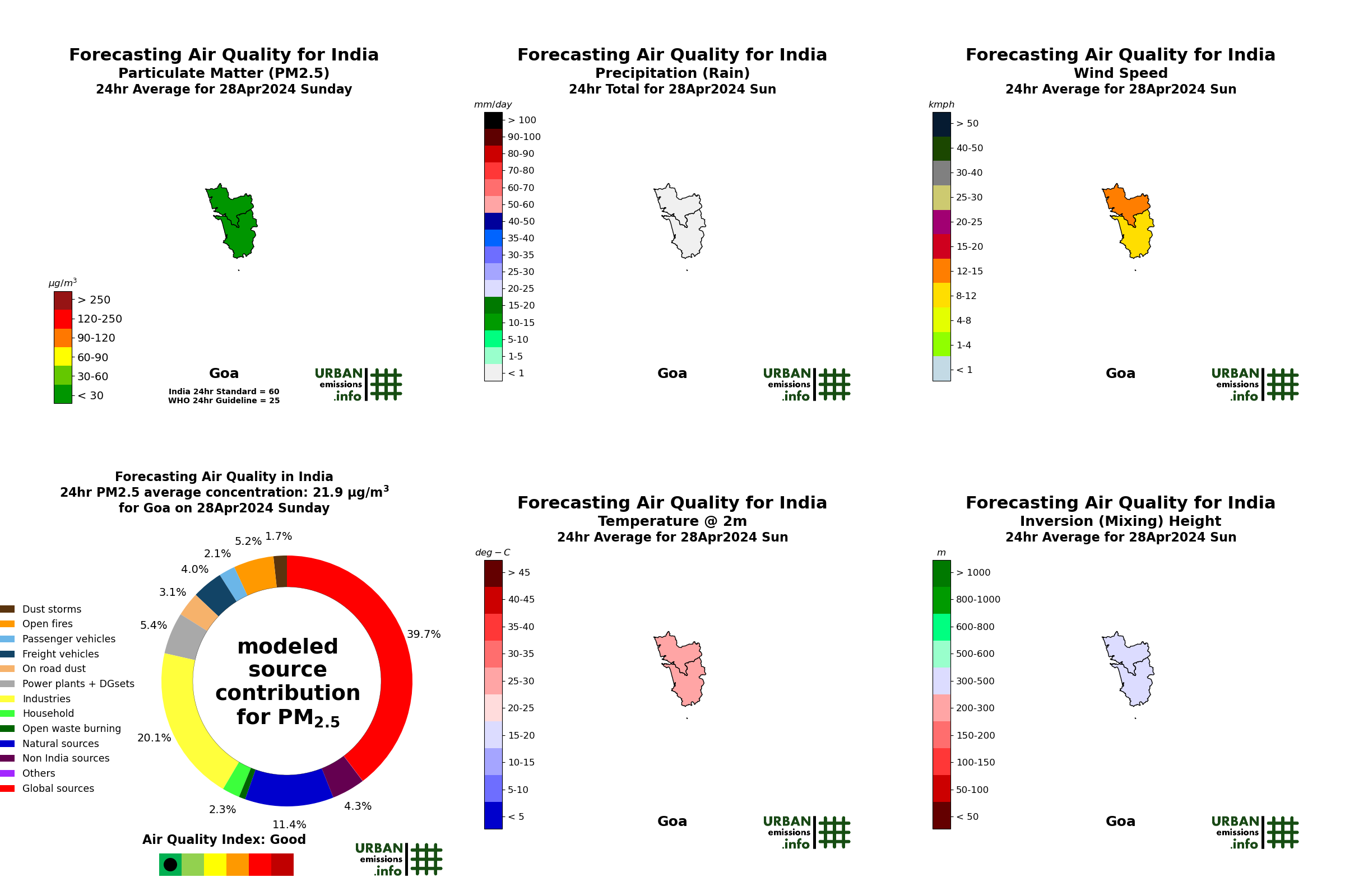
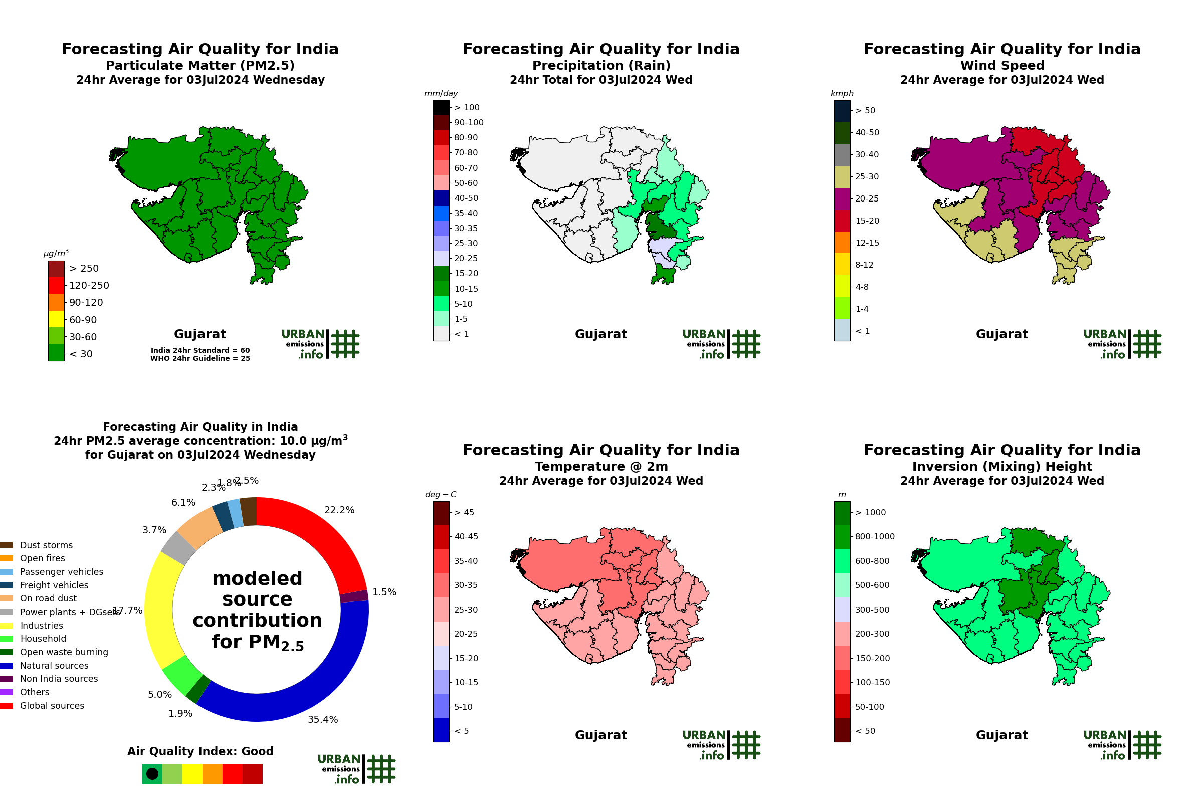
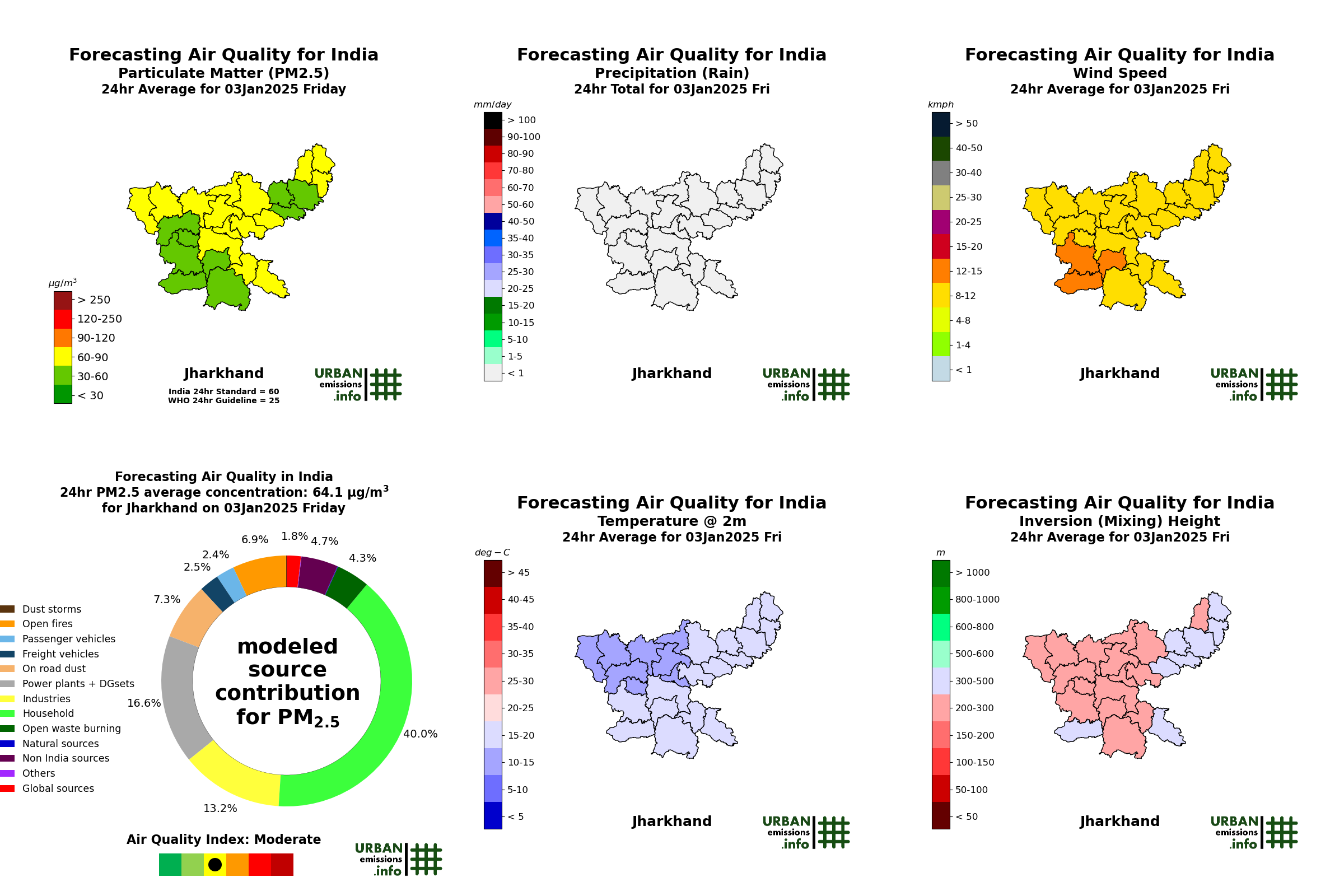
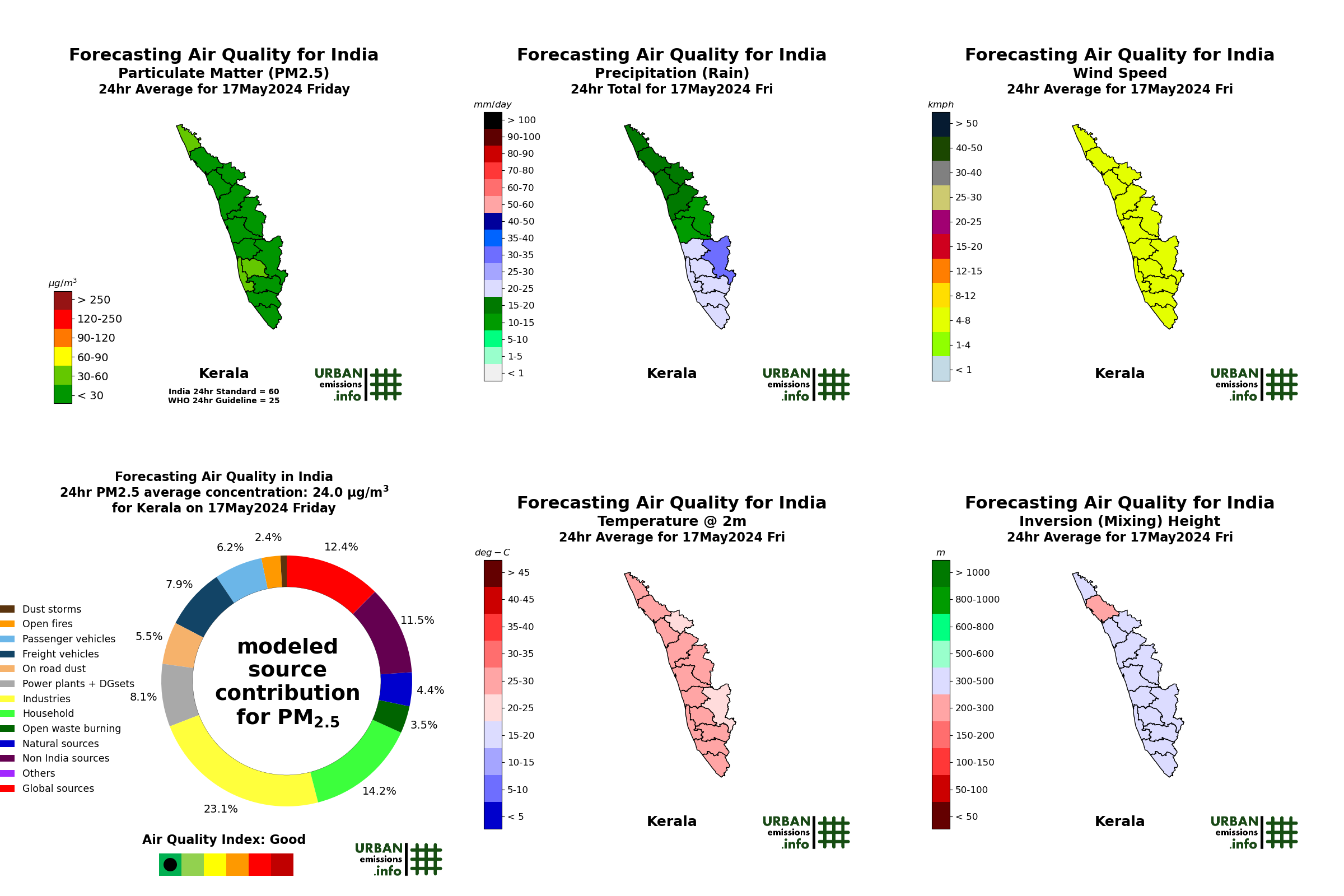
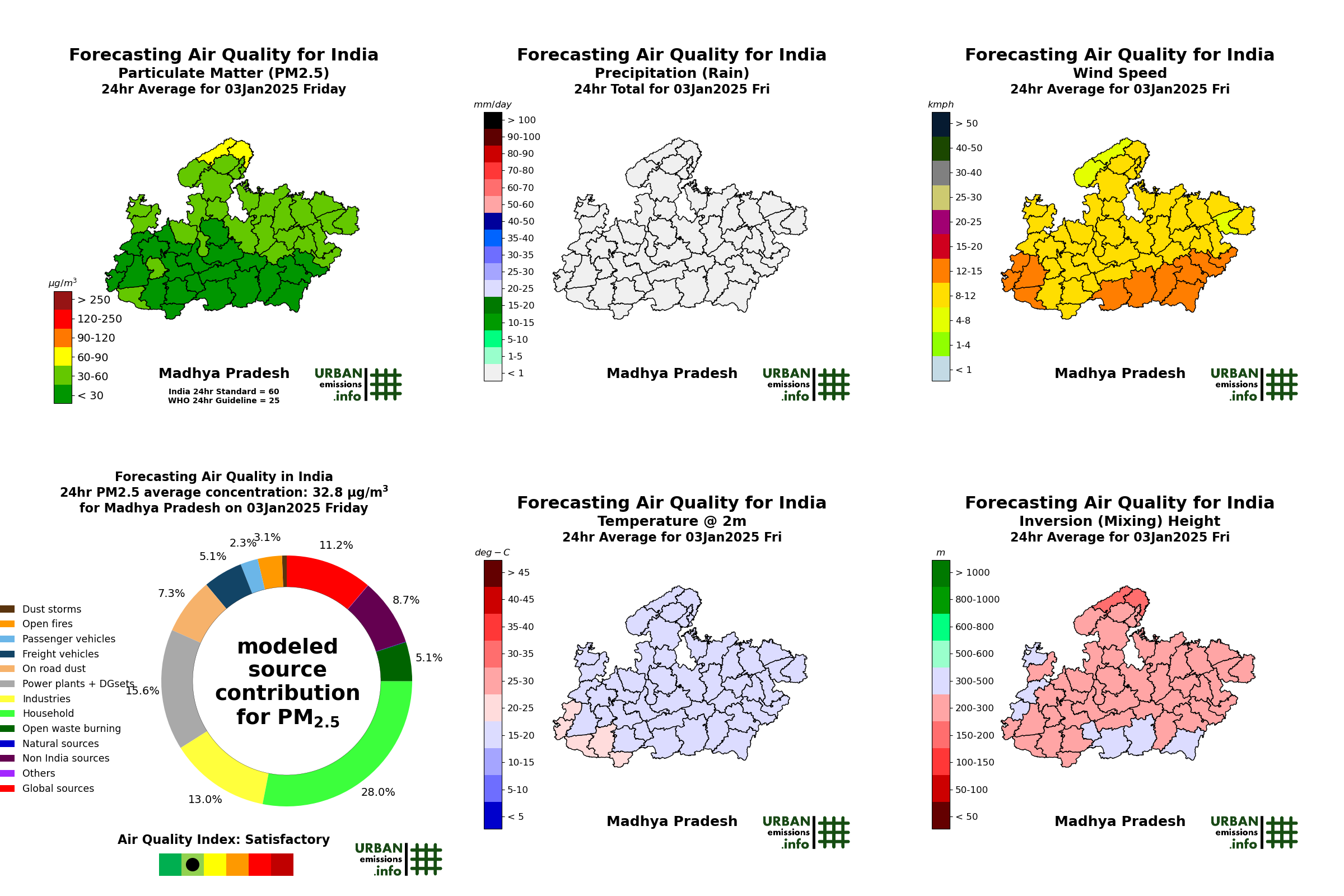
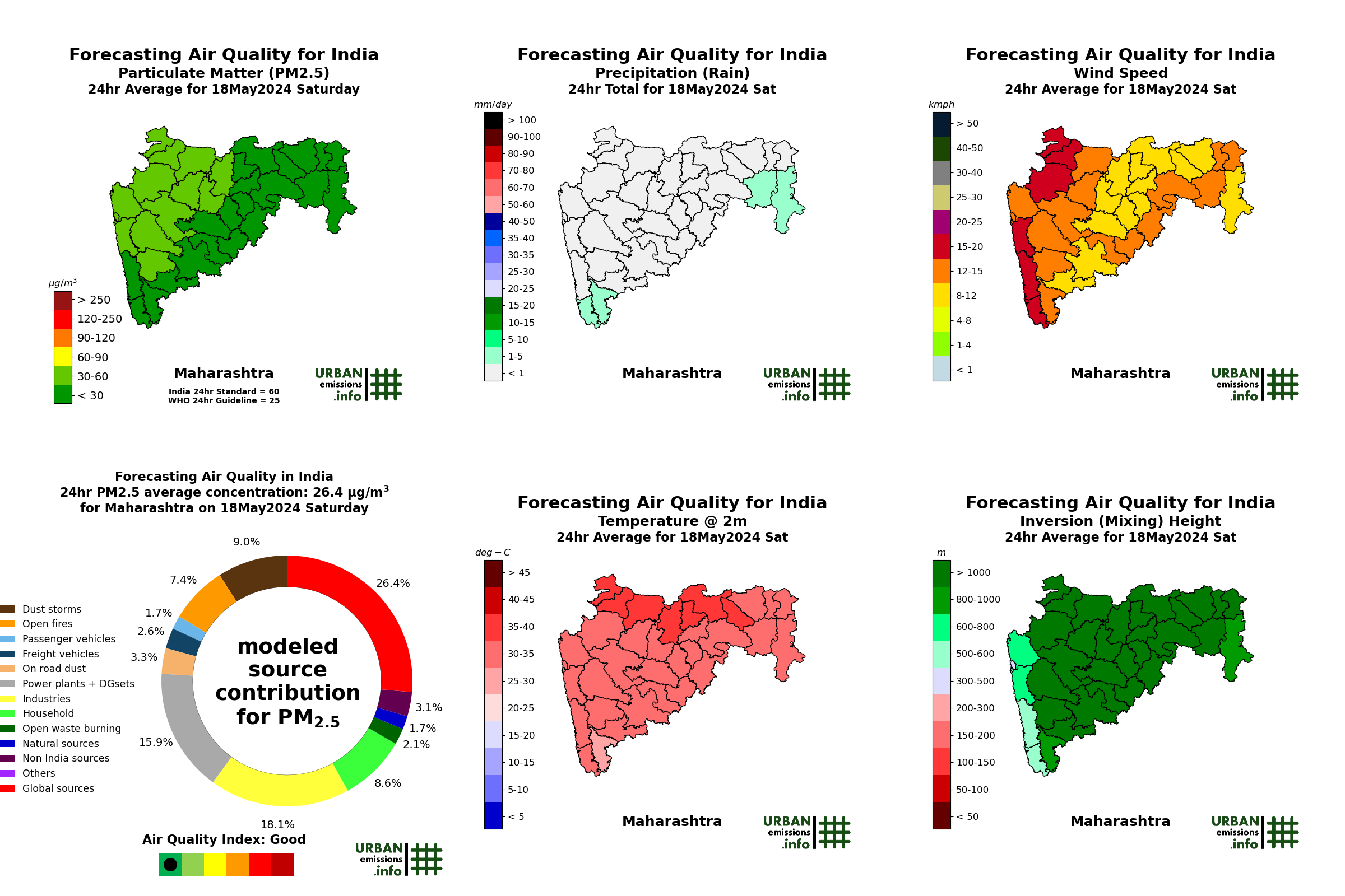
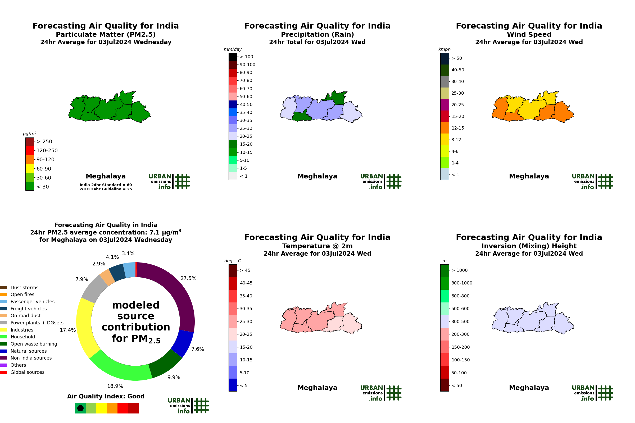
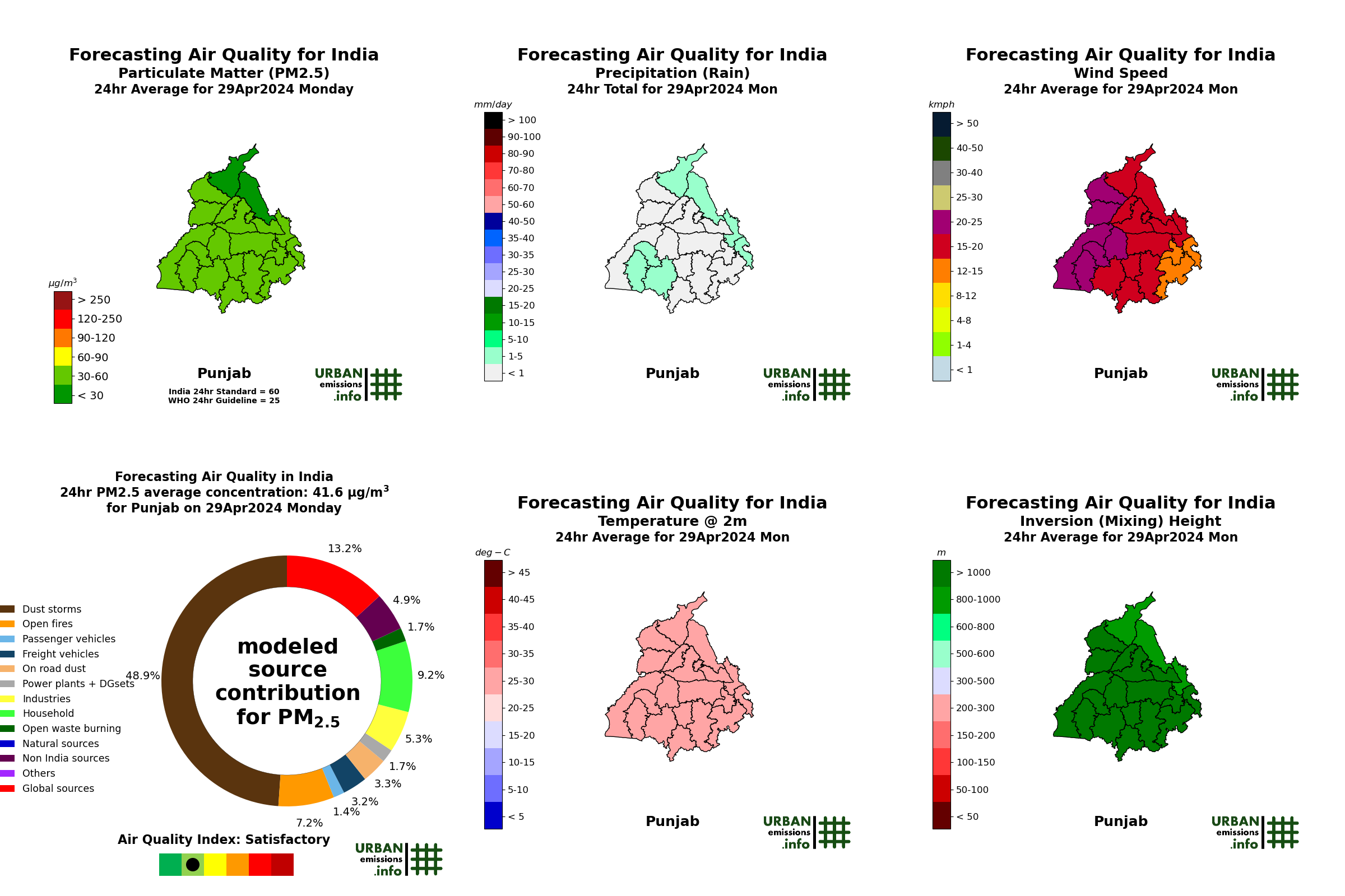
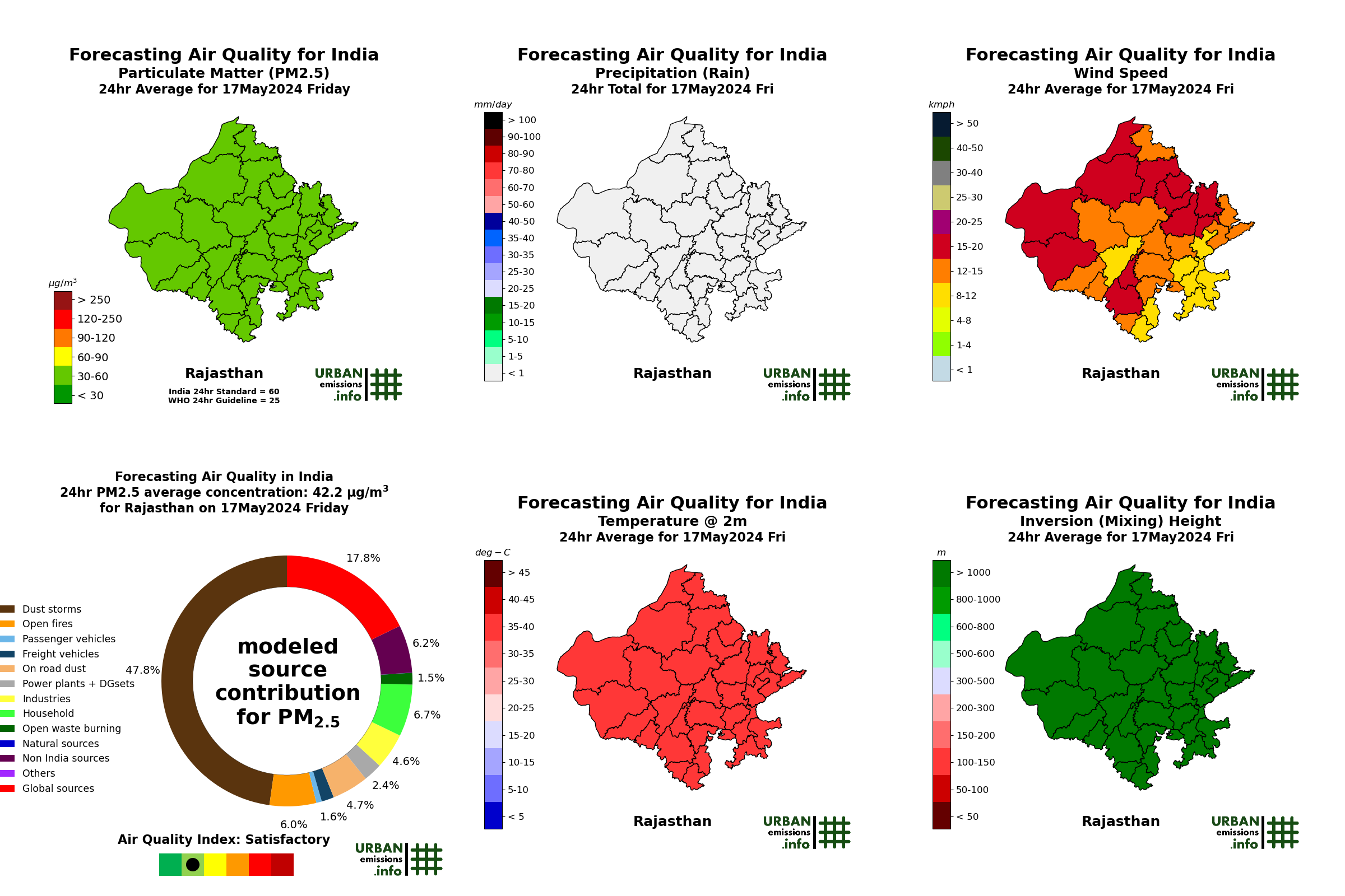
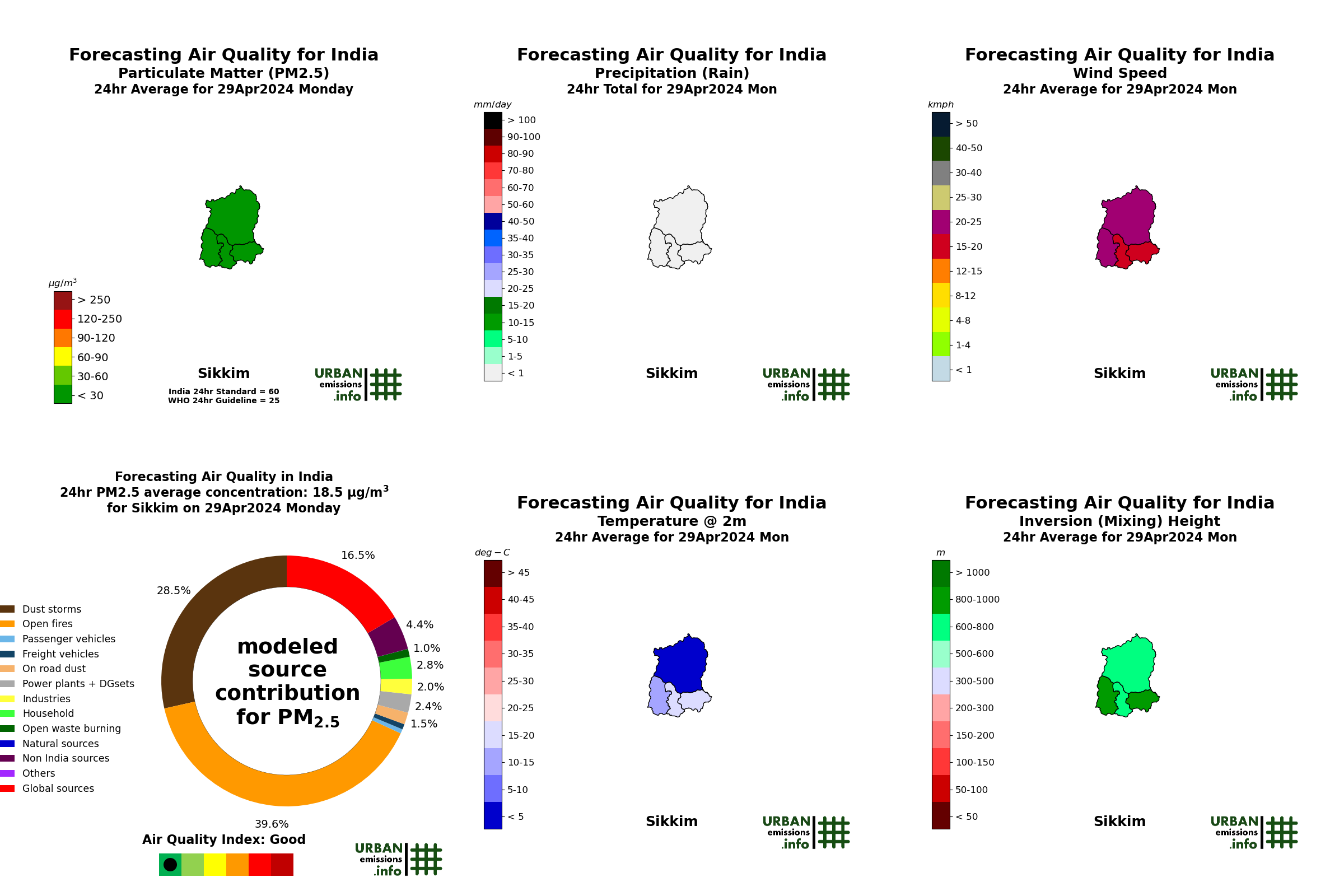
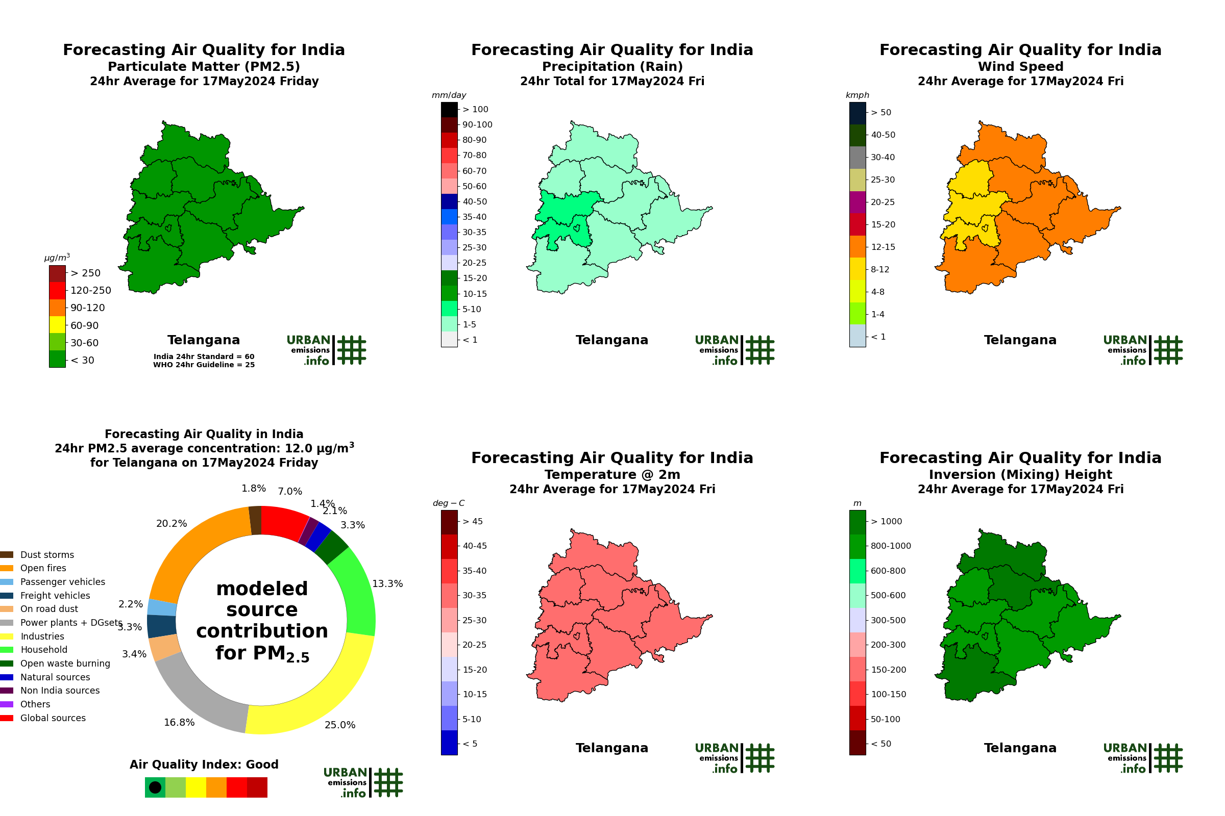
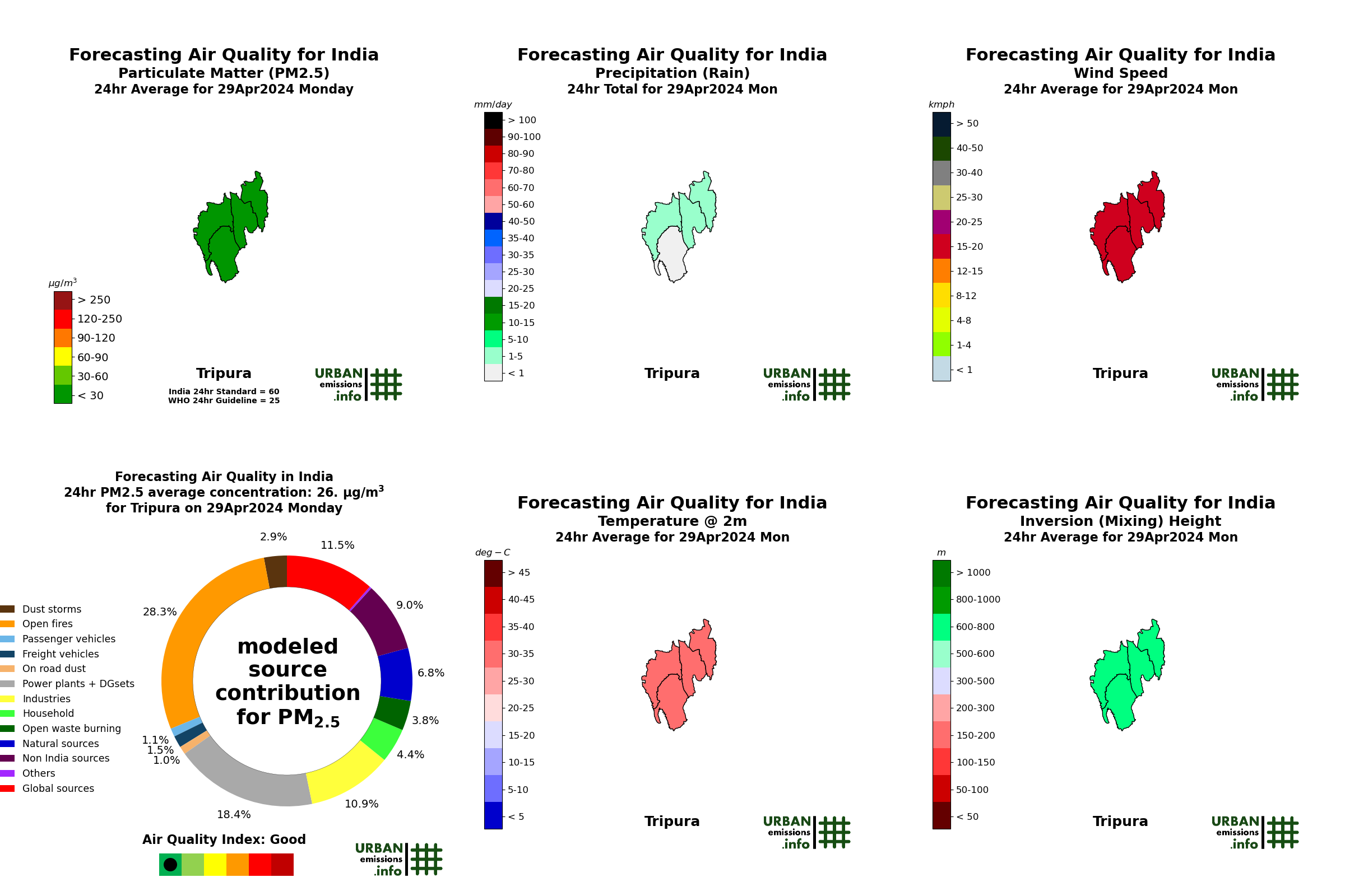
This page presents the modeled PM2.5 concentrations and modeled daily source contributions, summarized by state. All the simulation fields are updated everyday at 21:00 local time. Click here for the national maps and more details from the forecasting system.
AQI Summary by State |
|||
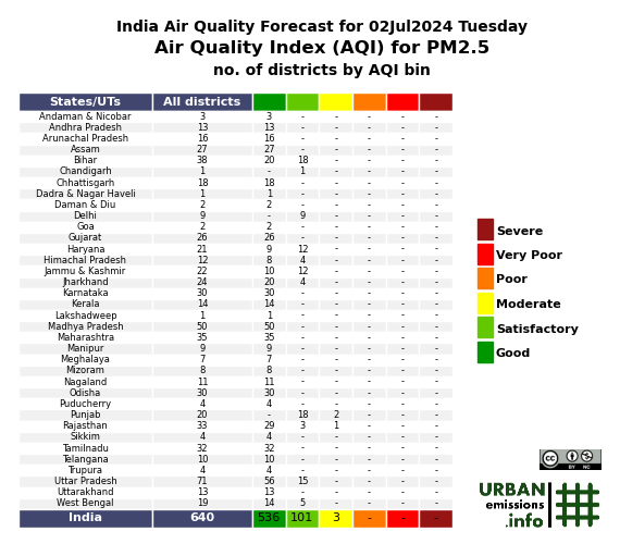 |
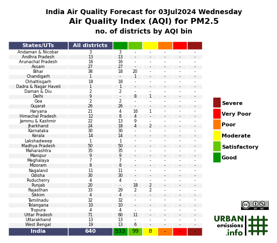 |
 |
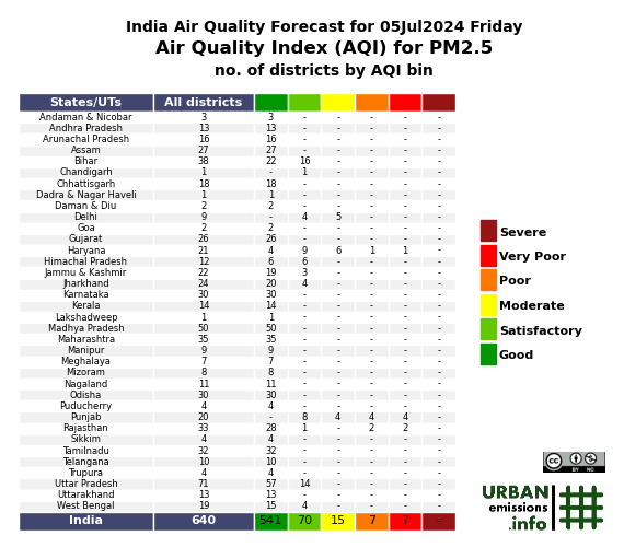 |
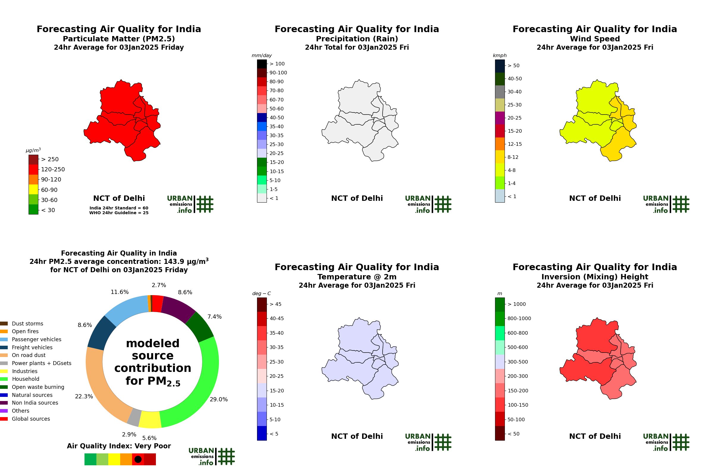
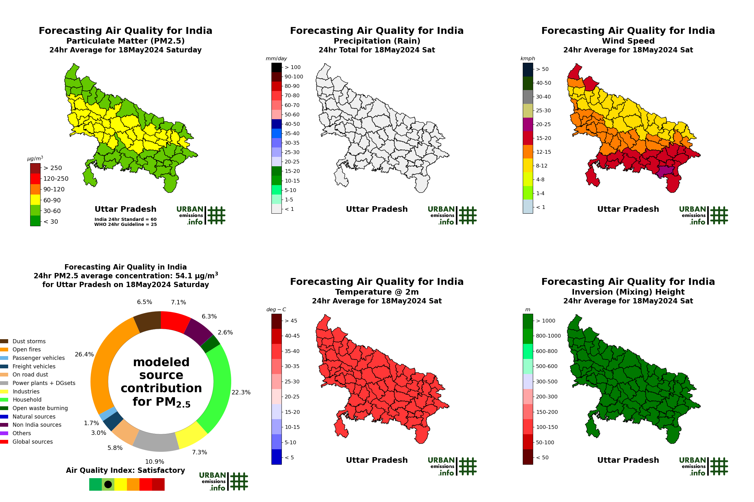
A composite of PM2.5 concentrations, source contributions, and meteorological parameters for today can be browsed by state below.
Back to the India air quality forecasting page. Additional data fields from the forecasting system
Send your queries to simair@urbanemissions.info